- EXPLORE Random Article

How to Find Happiness Within Yourself
Last Updated: July 28, 2023 Approved
This article was co-authored by Adam Dorsay, PsyD . Dr. Adam Dorsay is a licensed psychologist in private practice in San Jose, CA, and the co-creator of Project Reciprocity, an international program at Facebook's Headquarters, and a consultant with Digital Ocean’s Safety Team. He specializes in assisting high-achieving adults with relationship issues, stress reduction, anxiety, and attaining more happiness in their lives. In 2016 he gave a well-watched TEDx talk about men and emotions. Dr. Dorsay has a M.A. in Counseling from Santa Clara University and received his doctorate in Clinical Psychology in 2008. There are 15 references cited in this article, which can be found at the bottom of the page. wikiHow marks an article as reader-approved once it receives enough positive feedback. In this case, 100% of readers who voted found the article helpful, earning it our reader-approved status. This article has been viewed 246,110 times.
Many people find it hard to rely on themselves as a source of happiness. It is possible to find happiness inside yourself. There are different ways you can approach this and many techniques you can employ to help increase you feelings of inner happiness. You don't need to look beyond yourself to find your source of happiness. Just make sure you take the time to find it.
Defining the Road to Happiness

- Brainstorm to get many ideas down quickly.
- Make outlines to help structure your thoughts.
- Write an essay to help you fully articulate your thoughts.

- Be realistic. Acknowledge your situation and abilities when you’re planning. [2] X Research source
- Keep your goals action-oriented. Don't focus on things or on what you have or don't have. Focus on what you can do.
- Frame your goals in a positive light. You’re more likely to achieve your goals if you see them as something you’re working toward, not something you’re working against. [3] X Research source

- Pick a few goals and imagine that you have achieved them.
- Make sure these goals are personally meaningful, not status symbols.
- Write down all the details of your scenarios. Imagine characteristics you will need to make them work.
- Consider which of these traits and skills you already have.
Cultivating Happiness

- See yourself as cause, not consequence. Optimists believe negative events or experiences can be overcome. For example, if you're having a bad day, take it as a challenge. Don't let yourself feel defeated.
- Start small. Don’t feel you have to take on everything at once.

- Some people are grateful by nature, but you can train yourself to develop gratitude. [11] X Trustworthy Source Greater Good Magazine Journal published by UC Berkeley's Greater Good Science Center, which uses scientific research to promote happier living Go to source
- Make a time every day, like before dinner, to say things you're thankful for.
- Remember to thank store clerks, delivery people and coworkers more often.

- Try different kinds of meditation. Look online or talk to local meditation teachers to find ones best suited for you.
- Make it a regular habit. Meditation works best when it is done every day at the same time, so that you make it firmly part of a routine.
Dealing with Negativity

- When you feel like a failure, remind yourself of past success.
- If you're angry at someone, try to see it from their point of view.
- During sadness, make yourself watch funny movies or crack an impromptu joke.

- Treat yourself on a bad day.
- Do something that distracts you, to break your frame of mind.
- Get some rest and relaxation.

- Work to solve problems you're obsessing over. Instead of thinking about it, take action. Change the situation, or talk to people who can.
- Practice positive self-reflection. If you spend a lot of time thinking about your negative traits, interrupt your thoughts with self-praise. Tell yourself you did a great job or that you tried your best.

- Life coaches and spiritual mentors can help you with strategies for inner happiness.
- Therapists, psychologists and psychologists are qualified to help with mental health problems.
How Can You Find Happiness?
Expert Q&A

- Learn from yourself, teach yourself, love yourself. And, if you don't believe in yourself, then most of these things and positive things wouldn't be achieved! Thanks Helpful 106 Not Helpful 16
- If you feel frustrated, breathe in and out with your nose and listen to your breath. Thanks Helpful 100 Not Helpful 22
- Do things that are enjoyable to you!. Thanks Helpful 20 Not Helpful 2
You Might Also Like

- ↑ https://www.psychologytoday.com/blog/notes-self/201308/how-set-goals
- ↑ http://news.stanford.edu/news/2015/january/resolutions-succeed-mcgonigal-010615.html
- ↑ https://www.psychologytoday.com/blog/what-matters-most/201303/what-is-your-best-possible-self
- ↑ https://www.psychologytoday.com/blog/happiness-in-world/201306/how-optimism-can-be-learned
- ↑ http://greatergood.berkeley.edu/pdfs/GratitudePDFs/5Watkins-GratitudeHappiness.pdf
- ↑ http://greatergood.berkeley.edu/pdfs/GratitudePDFs/2Wood-GratitudeWell-BeingReview.pdf
- ↑ https://onlinelibrary.wiley.com/doi/abs/10.1111/j.1475-6811.2010.01273.x
- ↑ http://greatergood.berkeley.edu/topic/gratitude/definition#why_practice
- ↑ http://www.psy.miami.edu/faculty/mmccullough/Papers/Gratitude_CDPS_2008.pdf
- ↑ http://www.webmd.com/mental-health/features/forgive-forget
- ↑ http://www.healthlinkbc.ca/healthtopics/content.asp?hwid=uf9857
- ↑ http://greatergood.berkeley.edu/article/item/how_self_compassion_beats_rumination
- ↑ http://www.apa.org/monitor/nov05/cycle.aspx
About this article

If you want to find happiness within yourself, try taking time to write down what happiness means to you so you can have a solid goal to work towards. You can brainstorm lots of quick thoughts, create outlines, or even write an essay, as long as the process makes it easier for you to know what makes you happy. Once you have your thoughts on paper, use them to create realistic and action-oriented goals, rather than focusing on what you want or don’t have. For instance, you might envision yourself as happier if you eat healthier, so your goal might be to eat a serving of fresh vegetables with each meal. For more advice from our Mental Health co-author, like how to challenge your negative thoughts, scroll down. Did this summary help you? Yes No
Reader Success Stories
Jan 14, 2017
Did this article help you?
Jun 15, 2016
Jul 20, 2016
Jul 31, 2017
Elijah Thomas
Jul 22, 2018

- About wikiHow
- Terms of Use
- Privacy Policy
- Do Not Sell or Share My Info
- Not Selling Info
How to Find Inner Peace and Happiness (Incl. Mantras)

“The pursuit of inner peace is more important than the search for happiness or success .”
If you want to find inner peace and happiness, you have come to the right place. In this article, we explain the concept of peace (as well as inner peace), its relationship to happiness, and strategies to engage in which may result in an increase of one’s inner peace and happiness. Additionally, some practical mantras and useful quotes are noted as well.
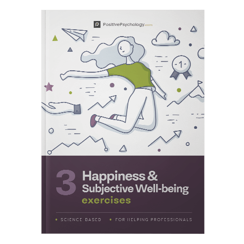
Before you continue, we thought you might like to download our three Happiness & Subjective Wellbeing Exercises for free . These detailed, science-based exercises will help you or your clients identify sources of authentic happiness and strategies to boost wellbeing.
This Article Contains:
What is peace and happiness in life, peace vs. happiness: is one more important, how to find inner peace and happiness, 3 mantras to cultivate inner peace and happiness, guided meditations to help foster inner peace and happiness, 10 quotes on inner peace and happiness, a take-home message.
Peace is a word, which has multiple meanings. It is a word with several dimensions used in varying contexts. For instance, Anderson (2014) posited that peace can be used in macro as well as micro contexts.
Global peace (e.g., peace treaties between countries; the harmonious relationship between societies) is an example of macro context usage.
On the other hand, personal peace (e.g., interpersonal peace and inner peace) is an example of micro-context usages. In this article, we focus on the micro context of peace. More specifically, inner peace in particular.
The dominant meaning of “peace” in Western civilization is the absence of violence (Anderson, 2004). However, the concept of associating inner peace within an individual is rooted in non-Western languages, cultures, and religions (Anderson, 2004). Arabic, Chinese, Hebrew, and Sanskrit have several words for peace.
In Sanskrit, words for peace also include Shanti and Chaina , which refers to an individual’s spiritual or inner peace and mental calmness (Anderson, 2004). Apart from a linguistic inquiry into peace, in some religions (e.g., Buddhism, Jainism, etc.), peace is used to underscore inner dimension (i.e., the person) more than the outer dimension (i.e., the environment) (Barua, 2014).
In general, peace of mind or inner peace refers to a deliberate state of either psychological or spiritual calmness despite the potential presence of stressors. It is a homeostatic psychological state, which results in the optimal functioning of the mind.
It has to be noted that given the complexity of the word – peace or inner peace, there is no general consensus with regards to its precise definition. Therefore, for the sake of clarity with regards to this article, we prescribe to the inner peace definition proposed by Ward (2010), Barua (2014) and Gogava, Poghosyan, and Aslanov (2018), which has also been employed in several works (e.g., Day, Casey, Ward, Howells, & Vess, 2013).
“Inner peace refers to a state of being mentally and spiritually at peace, with enough knowledge and understanding to keep oneself strong in the face of stress”
(Barua, 2014, p. 24).
Inner peace refers to
“a state of calm, serenity and tranquility of mind that arise due to having no sufferings or mental disturbances such as worry, anxiety, greed, desire, hatred, ill-will, delusion and/or other defilements”
(Gogava et al., 2018, p. 4).
“Inner peace refers to emotional self-regulation and the ability to achieve a state of dynamic emotional equilibrium and competence”
(Ward, 2010, p. 48).
Like peace, the word happiness is complex and subjective (for various definitions on happiness, see Kim-Prieto, Diener, Tamir, Scollon, & Diener, 2005 and Delle Fave et al., 2016). In fact, some scholars have even questioned the usefulness of happiness definition, equating it as a qualia concept (Wierzbicka, 2009).
For the sake of this article, we prescribe to the most popular definition that has been used by researchers from various fields (e.g., psychology and economists) (Delle Fave et al., 2016).
Happiness is typically associated with the concepts of life satisfaction and subjective wellbeing , which are a total score of cognitive and affective components of one’s mental state. Therefore, the following definition – happiness – refers to “to people’s evaluations of their lives – evaluations that are both affective and cognitive” (Diener, 2000, p. 34).
Peace and happiness are associated concepts (Cohrs, Christie, White, & Das, 2013). For instance, at the macro level, peaceful countries report a higher level of happiness in general. Likewise, a perusal of the definitions related to peace and happiness above makes their association quite clear. Some commonalities between these concepts include (Cohrs et al., 2013):
- Peace and happiness concepts are related to positive psychology, which includes peace psychology as well.
- Peace and happiness have been described as a positive human experience.
- Peace is associated with terms such as serenity, harmony, happiness, and well-being.

That is, does peace lead to happiness? Or, conversely, does happiness lead to peace?
In other words, the causality is not clear. Perhaps, the best way to describe their relationship for the time being, lest empirical studies prove it otherwise is – there is a symbiotic relationship between these two concepts. To elucidate, both inner peace and happiness are associated with positive emotions (e.g., Lyubomirsky, King, & Diener 2005).
Therefore, experiencing positive emotions can lead to increment in one’s inner peace as well as happiness levels.
Download 3 Free Happiness Exercises (PDF)
These detailed, science-based exercises will equip you or your clients with tools to discover authentic happiness and cultivate subjective well-being.
Download 3 Free Happiness Tools Pack (PDF)
By filling out your name and email address below.
- Email Address *
- Your Expertise * Your expertise Therapy Coaching Education Counseling Business Healthcare Other
- Phone This field is for validation purposes and should be left unchanged.
There are several ways of enhancing one’s inner peace and happiness. Below, we list three simple ways to achieve inner peace and happiness goals. Please be advised that the following ways are by no means an exhaustive list.
Several experts and philosophical treatise have alluded to human’s interaction with nature in increasing one’s inner peace. For instance, Robert Puff, a contributor to Psychology Today noted two types of human-nature interactions that can lead to increment in one’s inner peace and happiness levels.
- Nature in the short-term: Taking short walks outside on an everyday basis while abstaining from using one’s electronic devices.
- Nature in the long-term: Taking nature retreats for a few days. These retreats give us an opportunity to avoid day-to-day stress (e.g., work commute, workplace pressure, etc.) and focus on our bodies and minds. Retreats come in several forms and shapes such as visiting national parks, religious and non-religious retreat centers, among others.
The above proposition has been corroborated by several research studies (for an overview, see Capaldi, Dopko, & Zelenski, 2014). For instance, in their meta-analytic study, Capaldi et al. found that the human-nature relationship is connected such that being connected to nature can potentially lead to happiness.
2. Meditation
The health benefits of meditation have been well documented (e.g., Holzel et al., 2011). Examples of benefits include decrement in anxiety (Hofman, Sawyer, Witt, & Oh, 2010), reduction in cortisol levels (Carlson et al., 2007) and depression (Hofmann et al., 2010), among others.
In particular mindfulness meditation has been proposed to be a great way to enhance one’s wellbeing. Mindfulness refers to “ nonjudgmental attention to experiences in the present moment” (Holzel et al., 2011, p. 538), which can be cultivated by meditation practices such as sitting meditation, walking meditation, or mindful movements.
Meditation enhances an individual’s attention regulation (i.e., decrease in being distracted), emotion regulation (e.g., accepting one’s emotional state), and change in one’s self-perception (i.e., detachment from identification with a static sense of self) (Holzel et al., 2011) that leads to experiencing more positive emotions associated with happiness and inner peace.
In short, dedicating some time every day to practice mindfulness meditation is a definite route to increased inner peace and happiness. Here is further information related to meditation and practice .
3. Gratefulness
Being grateful for all that you have in life is one way to achieve inner peace and happiness.
Some scholars have even noted that happiness and gratefulness are one and the same. For example, the schematic hypothesis maintains that grateful individuals are more likely to notice positivity in life, and this influences their perception towards life events (Wood, Froh, & Geraghty, 2010).
It has been found that grateful people are well aware of life-challenges but choose not to focus on it. Instead, they underscore on the interconnectedness of life and are less propelled to materialistic goals than the general population (Easterbrook, 2003).
How to practice gratitude or being grateful? One approach to boost an individual’s gratefulness is the deliberate practice of counting one’s blessings and another means is to keep gratitude journals (Lai & O’Carroll, 2012).
In Sanskrit, the word “mantra” translates to mind tools or instruments. Considered to be sacred and to have a powerful impact on reprogramming our subconscious mind. When repeated frequently, it purifies one’s mind and soul.
Typically, mantras are in Sanskrit, an ancient language, considered by several linguistic scholars as a language that reverberates with a microcosm of our bodies and the macrocosm of the universe based on the science of sound.
Below we list 3 powerful mantras, which can be practiced every day that will enhance one’s inner peace and happiness.
Mantra 1: Om Sarvesham Svastir Bhavatu (i.e., universal peace prayer)
Meaning: May there be happiness in all, May there be peace in all, May there be completeness in all, May there be a success in all.
Mantra 2: Om Namah Shivaya (i.e., I bow to Shiva), which when practiced in the form of meditation results in calmness and self-confidence.
Mantra 3: Om or Aum (i.e., the sound of the universe and the sound of creation), which when chanted during meditation leads individuals to self-realization, freedom, and enlightenment.
Happiness is all in your mind – Gen Kelsang Nyema
There are several guided meditations to help an individual foster inner peace and happiness. Below we list four such guided meditations, which are either via audio CD, MP3 music, and Amazon videos.
Mindfulness Meditations: Finding Peace & Perspective in the Present Moment
This guided mindful meditation is by Traci Stein, a Columbia trained psychologist and hypnotherapist. This guided meditation is psychologically informed, which has documented evidence to show that it improved sleep, greater self-acceptance, and achieving a healthier weight.
This guided meditation is an amalgam of the best of classic contemplative meditation practice, state-of-the-art guided imagery and potent hypnotic suggestion. Formats: CD and MP3.
Guided Meditation for Deep Relaxation
This guided meditation is by Claudia Prana, a certified professional coach and hypnosis practitioner. This guided meditation is good for anyone, be it a beginner or an advanced meditation practitioner.
Guided Meditation is touted to help an individual to successfully achieve deep states of relaxation, stress relief and to help to fall asleep. Format: Video (available for free for Amazon Prime members).
Finding Tranquility – Guided Mindfulness Meditations for Stressful Times
This guided meditation titled “ Finding Tranquility ” encompasses several tracks, which include mindful meditation introduction, integrating mindfulness in everyday life, and four guided meditations for different purposes.
Available as MP3, audio CD, and live streaming via Amazon Music.
Guided Meditations: Fill What is Empty; Empty What is Full
This guided meditation encompasses several tracks. Several different types of meditations such as peace meditation, emotional healing meditation, and gratitude meditation.
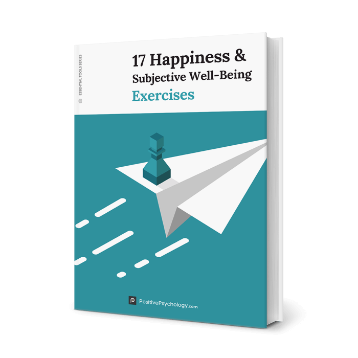
17 Exercises To Increase Happiness and Wellbeing
Add these 17 Happiness & Subjective Well-Being Exercises [PDF] to your toolkit and help others experience greater purpose, meaning, and positive emotions.
Created by Experts. 100% Science-based.
If you aim for inner peace and happiness, you might find the following useful. Also, quotes are easy to share one’s knowledge with others, with regards to complex topics and ideas.

I hope that you have a better grasp of inner peace and happiness. The route to inner peace and happiness is not difficult. Instead, it comes from simple lifestyle changes and persistence. From meditating a few minutes a day to taking a walk in nature, to maintaining a gratitude journal .
What are your thoughts on inner peace and happiness? Do you have any recommendations to find inner peace and happiness? Please let us know in the comments section below.
Thanks for taking the time to read our post!
We hope you enjoyed reading this article. Don’t forget to download our three Happiness Exercises for free .
- Anderson, R. (2004). A definition of peace. Peace and Conflict: Journal of Peace Psychology, 10 (2), 101-116.
- Barua, B. T. (2014). World peace and the goals of Buddhists . Accessed at: scholar.google.com.
- Capaldi, C. A., Dopko, R. L., & Zelenski, J. M. (2014). The relationship between nature connectedness and happiness: A meta-analysis. Frontiers in Psychology, 5 , 976.
- Carlson, L. E., Speca, M., Faris, P., & Patel, K. D. (2007). One year pre–post intervention follow-up of psychological, immune, endocrine and blood pressure outcomes of mindfulness-based stress reduction (MBSR) in breast and prostate cancer outpatients. Brain, Behavior, and Immunity, 21 (8), 1038-1049.
- Casey, S., Day, A., Vess, J., & Ward, T. (2012). Foundations of offender rehabilitation . NY: Routledge.
- Cohrs, J. C., Christie, D. J., White, M. P., & Das, C. (2013). Contributions of positive psychology to peace: Toward global well-being and resilience. American Psychologist, 68 (7), 590.
- Delle Fave, A., Brdar, I., Wissing, M. P., Araujo, U., Castro Solano, A., Freire, T., … & Nakamura, J. (2016). Lay definitions of happiness across nations: The primacy of inner harmony and relational connectedness. Frontiers in Psychology, 7 , 30.
- Diener, E. (2000). Subjective well-being: The science of happiness and a proposal for a national index. American Psychologist, 55 (1), 34.
- Easterbrook, G. (2003). The progress paradox . Books on Tape.
- Gogava, I., Poghosyan, L., & Aslanov, B. Manual for educators . Accessed at: scholar.google.com.
- Hofmann, S. G., Sawyer, A. T., Witt, A. A., & Oh, D. (2010). The effect of mindfulness-based therapy on anxiety and depression: A meta-analytic review. Journal of Consulting and Clinical Psychology, 78 (2), 169.
- Hölzel, B. K., Lazar, S. W., Gard, T., Schuman-Olivier, Z., Vago, D. R., & Ott, U. (2011). How does mindfulness meditation work? Proposing mechanisms of action from a conceptual and neural perspective. Perspectives on Psychological Science, 6 (6), 537-559.
- Kim-Prieto, C., Diener, E., Tamir, M., Scollon, C., & Diener, M. (2005). Integrating the diverse definitions of happiness: A time-sequential framework of subjective well-being. Journal of Happiness Studies, 6 (3), 261-300.
- Lai, S. T., & O’Carroll, R. E. (2017). ‘The Three Good Things’-the effects of gratitude practice on wellbeing: a randomized controlled trial. Health Psychology Update, 26 , 10-18.
- Lyubomirsky, S., King, L., & Diener, E. (2005). The benefits of frequent positive affect: Does happiness lead to success? Psychological Bulletin, 131 (6), 803.
- Ward, T. (2010). The good lives model of offender rehabilitation: Basic assumptions, etiological commitments, and practice implications. Offender supervision: New directions in theory, research and practice , 41-64.
- Wierzbicka, A. (2004). ‘Happiness’ in cross-linguistic & cross-cultural perspective. Daedalus , 133(2), 34-43.
- Wood, A. M., Froh, J. J., & Geraghty, A. W. (2010). Gratitude and well-being: A review and theoretical integration. Clinical Psychology Review, 30 (7), 890-905.

Share this article:
Article feedback
What our readers think.

Really enlightening & useful article!

Hightest people + precious thoughts! I found this site really wonderful. I ‘m totally inspired & impressed by your great work. Have good luck forever.

If you can’t find peace within, you will never find it. True that.

I agree with you to a large extent that we mostly do not pay attention to all these things and basically this is also the reason for our sorrow. Thank you…

When you mentioned mantras you could have given credits to the source.
Let us know your thoughts Cancel reply
Your email address will not be published.
Save my name, email, and website in this browser for the next time I comment.
Related articles

Embracing JOMO: Finding Joy in Missing Out
We’ve probably all heard of FOMO, or ‘the fear of missing out’. FOMO is the currency of social media platforms, eager to encourage us to [...]

The True Meaning of Hedonism: A Philosophical Perspective
“If it feels good, do it, you only live once”. Hedonists are always up for a good time and believe the pursuit of pleasure and [...]

Happiness Economics: Can Money Buy Happiness?
Do you ever daydream about winning the lottery? After all, it only costs a small amount, a slight risk, with the possibility of a substantial [...]
Read other articles by their category
- Body & Brain (48)
- Coaching & Application (57)
- Compassion (26)
- Counseling (51)
- Emotional Intelligence (24)
- Gratitude (18)
- Grief & Bereavement (21)
- Happiness & SWB (40)
- Meaning & Values (26)
- Meditation (20)
- Mindfulness (45)
- Motivation & Goals (45)
- Optimism & Mindset (34)
- Positive CBT (27)
- Positive Communication (20)
- Positive Education (47)
- Positive Emotions (32)
- Positive Leadership (16)
- Positive Psychology (33)
- Positive Workplace (36)
- Productivity (16)
- Relationships (49)
- Resilience & Coping (34)
- Self Awareness (21)
- Self Esteem (37)
- Strengths & Virtues (30)
- Stress & Burnout Prevention (34)
- Theory & Books (46)
- Therapy Exercises (37)
- Types of Therapy (64)
- Comments This field is for validation purposes and should be left unchanged.
3 Happiness Exercises Pack [PDF]
- Bipolar Disorder
- Therapy Center
- When To See a Therapist
- Types of Therapy
- Best Online Therapy
- Best Couples Therapy
- Best Family Therapy
- Managing Stress
- Sleep and Dreaming
- Understanding Emotions
- Self-Improvement
- Healthy Relationships
- Student Resources
- Personality Types
- Verywell Mind Insights
- 2023 Verywell Mind 25
- Mental Health in the Classroom
- Editorial Process
- Meet Our Review Board
- Crisis Support
What Is Happiness?
Defining Happiness, and How to Become Happier
Kendra Cherry, MS, is a psychosocial rehabilitation specialist, psychology educator, and author of the "Everything Psychology Book."
:max_bytes(150000):strip_icc():format(webp)/IMG_9791-89504ab694d54b66bbd72cb84ffb860e.jpg "how to find happiness within yourself essay")
Rachel Goldman, PhD FTOS, is a licensed psychologist, clinical assistant professor, speaker, wellness expert specializing in eating behaviors, stress management, and health behavior change.
:max_bytes(150000):strip_icc():format(webp)/Rachel-Goldman-1000-a42451caacb6423abecbe6b74e628042.jpg "how to find happiness within yourself essay")
Verywell/ Jiaqi Zhou
How to Cultivate Happiness
How to be a happier person.
Happiness is something that people seek to find, yet what defines happiness can vary from one person to the next. Typically, happiness is an emotional state characterized by feelings of joy, satisfaction, contentment, and fulfillment. While happiness has many different definitions, it is often described as involving positive emotions and life satisfaction.
When most people talk about the true meaning of happiness, they might be talking about how they feel in the present moment or referring to a more general sense of how they feel about life overall.
Because happiness tends to be such a broadly defined term, psychologists and other social scientists typically use the term ' subjective well-being ' when they talk about this emotional state. Just as it sounds, subjective well-being tends to focus on an individual's overall personal feelings about their life in the present.
Two key components of happiness (or subjective well-being) are:
- The balance of emotions: Everyone experiences both positive and negative emotions, feelings, and moods. Happiness is generally linked to experiencing more positive feelings than negative ones.
- Life satisfaction: This relates to how satisfied you feel with different areas of your life including your relationships, work, achievements, and other things that you consider important.
Another definition of happiness comes from the ancient philosopher Aristotle, who suggested that happiness is the one human desire, and all other human desires exist as a way to obtain happiness. He believed that there were four levels of happiness: happiness from immediate gratification, from comparison and achievement, from making positive contributions, and from achieving fulfillment.
Happiness, Aristotle suggested, could be achieved through the golden mean, which involves finding a balance between deficiency and excess.
Signs of Happiness
While perceptions of happiness may be different from one person to the next, there are some key signs that psychologists look for when measuring and assessing happiness.
Some key signs of happiness include:
- Feeling like you are living the life you wanted
- Going with the flow and a willingness to take life as it comes
- Feeling that the conditions of your life are good
- Enjoying positive, healthy relationships with other people
- Feeling that you have accomplished (or will accomplish) what you want in life
- Feeling satisfied with your life
- Feeling positive more than negative
- Being open to new ideas and experiences
- Practicing self-care and treating yourself with kindness and compassion
- Experiencing gratitude
- Feeling that you are living life with a sense of meaning and purpose
- Wanting to share your happiness and joy with others
One important thing to remember is that happiness isn't a state of constant euphoria . Instead, happiness is an overall sense of experiencing more positive emotions than negative ones.
Happy people still feel the whole range of human emotions—anger, frustrastion, boredom, loneliness, and even sadness—from time to time. But even when faced with discomfort, they have an underlying sense of optimism that things will get better, that they can deal with what is happening, and that they will be able to feel happy again.
Types of Happiness
There are many different ways of thinking about happiness. For example, the ancient Greek philosopher Aristotle made a distinction between two different kinds of happiness: hedonia and eudaimonia.
- Hedonia: Hedonic happiness is derived from pleasure. It is most often associated with doing what feels good, self-care, fulfilling desires, experiencing enjoyment, and feeling a sense of satisfaction.
- Eudaimonia: This type of happiness is derived from seeking virtue and meaning. Important components of eudaimonic well-being including feeling that your life has meaning, value, and purpose. It is associated more with fulfilling responsibilities, investing in long-term goals, concern for the welfare of other people, and living up to personal ideals.
Hedonia and eudemonia are more commonly known today in psychology as pleasure and meaning, respectively. More recently, psychologists have suggested the addition of the third component that relates to engagement . These are feelings of commitment and participation in different areas of life.
Research suggests that happy people tend to rank pretty high on eudaimonic life satisfaction and better than average on their hedonic life satisfaction.
All of these can play an important role in the overall experience of happiness, although the relative value of each can be highly subjective. Some activities may be both pleasurable and meaningful, while others might skew more one way or the other.
For example, volunteering for a cause you believe in might be more meaningful than pleasurable. Watching your favorite tv show, on the other hand, might rank lower in meaning and higher on pleasure.
Some types of happiness that may fall under these three main categories include:
- Joy: A often relatively brief feeling that is felt in the present moment
- Excitement: A happy feeling that involves looking forward to something with positive anticipation
- Gratitude: A positive emotion that involves being thankful and appreciative
- Pride: A feeling of satisfaction in something that you have accomplished
- Optimism: This is a way of looking at life with a positive, upbeat outlook
- Contentment: This type of happiness involves a sense of satisfaction
While some people just tend to be naturally happier, there are things that you can do to cultivate your sense of happiness.
Pursue Intrinsic Goals
Achieving goals that you are intrinsically motivated to pursue, particularly ones that are focused on personal growth and community, can help boost happiness. Research suggests that pursuing these types of intrinsically-motivated goals can increase happiness more than pursuing extrinsic goals like gaining money or status.
Enjoy the Moment
Studies have found that people tend to over earn—they become so focused on accumulating things that they lose track of actually enjoying what they are doing.
So, rather than falling into the trap of mindlessly accumulating to the detriment of your own happiness, focus on practicing gratitude for the things you have and enjoying the process as you go.
Reframe Negative Thoughts
When you find yourself stuck in a pessimistic outlook or experiencing negativity, look for ways that you can reframe your thoughts in a more positive way.
People have a natural negativity bias , or a tendency to pay more attention to bad things than to good things. This can have an impact on everything from how you make decisions to how you form impressions of other people. Discounting the positive—a cognitive distortion where people focus on the negative and ignore the positive—can also contribute to negative thoughts.
Reframing these negative perceptions isn't about ignoring the bad. Instead, it means trying to take a more balanced, realistic look at events. It allows you to notice patterns in your thinking and then challenge negative thoughts.
Impact of Happiness
Why is happiness so important? Happiness has been shown to predict positive outcomes in many different areas of life including mental well-being, physical health, and overall longevity.
- Positive emotions increase satisfaction with life.
- Happiness helps people build stronger coping skills and emotional resources.
- Positive emotions are linked to better health and longevity. One study found that people who experienced more positive emotions than negative ones were more likely to have survived over a 13 year period.
- Positive feelings increase resilience. Resilience helps people better manage stress and bounce back better when faced with setbacks. For example, one study found that happier people tend to have lower levels of the stress hormone cortisol and that these benefits tend to persist over time.
- People who report having a positive state of well-being are more likely to engage in healthy behaviors such as eating fruits and vegetables and engaging in regular physical exercise.
- Being happy may make help you get sick less often. Happier mental states are linked to increased immunity.
Some people seem to have a naturally higher baseline for happiness—one large-scale study of more than 2,000 twins suggested that around 50% of overall life satisfaction was due to genetics, 10% to external events, and 40% to individual activities.
So while you might not be able to control what your “base level” of happiness is, there are things that you can do to make your life happier and more fulfilling. Even the happiest of individuals can feel down from time to time and happiness is something that all people need to consciously pursue.
Cultivate Strong Relationships
Social support is an essential part of well-being. Research has found that good social relationships are the strongest predictor of happiness. Having positive and supportive connections with people you care about can provide a buffer against stress, improve your health, and help you become a happier person.
In the Harvard Study of Adult Development, a longitudinal study that looked at participants over 80 years, researchers found that relationships and how happy people are in those relationships strongly impacted overall health.
So if you are trying to improve your happiness, cultivating solid social connections is a great place to start. Consider deepening your existing relationships and explore ways to make new friends.
Get Regular Exercise
Exercise is good for both your body and mind. Physical activity is linked to a range of physical and psychological benefits including improved mood. Numerous studies have shown that regular exercise may play a role in warding off symptoms of depression, but evidence also suggests that it may also help make people happier, too.
In one analysis of past research on the connection between physical activity and happiness, researchers found a consistent positive link.
Even a little bit of exercise produces a happiness boost—people who were physically active for as little as 10 minutes a day or who worked out only once a week had higher levels of happiness than people who never exercised.
Show Gratitude
In one study, participants were asked to engage in a writing exercise for 10 to 20 minutes each night before bed. Some were instructed to write about daily hassles, some about neutral events, and some about things they were grateful for. The results found that people who had written about gratitude had increase positive emotions, increased subjective happiness, and improve life satisfaction.
As the authors of the study suggest, keeping a gratitude list is a relatively easy, affordable, simple, and pleasant way to boost your mood. Try setting aside a few minutes each night to write down or think about things in your life that you are grateful for.
Find a Sense of Purpose
Research has found that people who feel like they have a purpose have better well-being and feel more fulfilled. A sense of purpose involves seeing your life as having goals, direction, and meaning. It may help improve happiness by promoting healthier behaviors.
Some things you can do to help find a sense of purpose include:
- Explore your interests and passions
- Engage in prosocial and altruistic causes
- Work to address injustices
- Look for new things you might want to learn more about
This sense of purpose is influenced by a variety of factors, but it is also something that you can cultivate. It involves finding a goal that you care deeply about that will lead you to engage in productive, positive actions in order to work toward that goal.
Press Play for Advice On Reaching Your Dreams
Hosted by therapist Amy Morin, LCSW, this episode of The Verywell Mind Podcast , featuring best-selling author Dave Hollis, shares how to create your best life. Click below to listen now.
Follow Now : Apple Podcasts / Spotify / Google Podcasts
Challenges of Finding Happiness
While seeking happiness is important, there are times when the pursuit of life satisfaction falls short. Some challenges to watch for include:
Valuing the Wrong Things
Money may not be able to buy happiness, but there is research that spending money on things like experiences can make you happier than spending it on material possessions.
One study, for example, found that spending money on things that buy time—such as spending money on time-saving services—can increase happiness and life satisfaction.
Rather than overvaluing things such as money, status, or material possessions, pursuing goals that result in more free time or enjoyable experiences may have a higher happiness reward.
Not Seeking Social Support
Social support means having friends and loved ones that you can turn to for support. Research has found that perceived social support plays an important role in subjective well-being. For example, one study found that perceptions of social support were responsible for 43% of a person's level of happiness.
It is important to remember that when it comes to social support, quality is more important than quantity. Having just a few very close and trusted friends will have a greater impact on your overall happiness than having many casual acquaintances.
Thinking of Happiness as an Endpoint
Happiness isn’t a goal that you can simply reach and be done with. It is a constant pursuit that requires continual nurturing and sustenance.
One study found that people who tend to value happiness most also tended to feel the least satisfied with their lives. Essentially, happiness becomes such a lofty goal that it becomes virtually unattainable.
“Valuing happiness could be self-defeating because the more people value happiness, the more likely they will feel disappointed,” suggest the authors of the study.
Perhaps the lesson is to not make something as broadly defined as “happiness” your goal. Instead, focus on building and cultivating the sort of life and relationships that bring fulfillment and satisfaction to your life.
It is also important to consider how you personally define happiness. Happiness is a broad term that means different things to different people. Rather than looking at happiness as an endpoint, it can be more helpful to think about what happiness really means to you and then work on small things that will help you become happier. This can make achieving these goals more manageable and less overwhelming.
History of Happiness
Happiness has long been recognized as a critical part of health and well-being. The "pursuit of happiness" is even given as an inalienable right in the U.S. Declaration of Independence. Our understanding of what will bring happiness, however, has shifted over time.
Psychologists have also proposed a number of different theories to explain how people experience and pursue happiness. These theories include:
Maslow's Hierarchy of Needs
The hierarchy of needs suggests that people are motivated to pursue increasingly complex needs. Once more basic needs are fulfilled, people are then motivated by more psychological and emotional needs.
At the peak of the hierarchy is the need for self-actualization, or the need to achieve one's full potential. The theory also stresses the importance of peak experiences or transcendent moments in which a person feels deep understanding, happiness, and joy.
Positive Psychology
The pursuit of happiness is central to the field of positive psychology . Psychologists who study positive psychology are interested in learning ways to increase positivity and helping people live happier, more satisfying lives.
Rather than focusing on mental pathologies, the field instead strives to find ways to help people, communities, and societies improve positive emotions and achieve greater happiness.
Finley K, Axner M, Vrooman K, Tse D. Ideal levels of prosocial involvement in relation to momentary affect and eudaimonia: Exploring the golden mean . Innov Aging . 2020;4(Suppl 1):614. doi:10.1093/geroni/igaa057.2083
Kringelbach ML, Berridge KC. The neuroscience of happiness and pleasure . Soc Res (New York) . 2010;77(2):659-678.
Panel on Measuring Subjective Well-Being in a Policy-Relevant Framework; Committee on National Statistics; Division on Behavioral and Social Sciences and Education; National Research Council; Stone AA, Mackie C, editors. Subjective Well-Being: Measuring Happiness, Suffering, and Other Dimensions of Experience [Internet]. Washington (DC): National Academies Press (US).
Lee MA, Kawachi I. The keys to happiness: Associations between personal values regarding core life domains and happiness in South Korea . PLoS One . 2019;14(1):e0209821. doi:10.1371/journal.pone.0209821
Hsee CK, Zhang J, Cai CF, Zhang S. Overearning . Psychol Sci . 2013;24(6):852-9
Carstensen LL, Turan B, Scheibe S, et al. Emotional experience improves with age: evidence based on over 10 years of experience sampling . Psychol Aging . 2011;26(1):21‐33. doi:10.1037/a0021285
Steptoe A, Wardle J. Positive affect and biological function in everyday life . Neurobiol Aging . 2005;26 Suppl 1:108‐112. doi:10.1016/j.neurobiolaging.2005.08.016
Sapranaviciute-Zabazlajeva L, Luksiene D, Virviciute D, Bobak M, Tamosiunas A. L ink between healthy lifestyle and psychological well-being in Lithuanian adults aged 45-72: a cross-sectional study . BMJ Open . 2017;7(4):e014240. doi:10.1136/bmjopen-2016-014240
Costanzo ES, Lutgendorf SK, Kohut ML, et al. Mood and cytokine response to influenza virus in older adults . J Gerontol A Biol Sci Med Sci . 2004;59(12):1328‐1333. doi:10.1093/gerona/59.12.1328
Lyubomirsky S, Sheldon KM, Schkade D. Pursuing happiness: The architecture of sustainable change . Review of General Psychology. 2005;9 (2):111–131. doi:0.1037/1089-2680.9.2.111
The Harvard Gazette. Good genes are nice, but joy is better .
Zhang Z, Chen W. A systematic review of the relationship between physical activity and happiness . J Happiness Stud 20, 1305–1322 (2019). https://doi.org/10.1007/s10902-018-9976-0
Cunha LF, Pellanda LC, Reppold CT. Positive psychology and gratitude interventions: a randomized clinical trial . Front Psychol . 2019;10:584. Published 2019 Mar 21. doi:10.3389/fpsyg.2019.00584
Ryff CD. Psychological well-being revisited: advances in the science and practice of eudaimonia . Psychother Psychosom . 2014;83(1):10‐28. doi:10.1159/000353263
Whillans AV, Dunn EW, Smeets P, Bekkers R, Norton MI. Buying time promotes happiness . Proc Natl Acad Sci U S A . 2017;114(32):8523‐8527. doi:10.1073/pnas.1706541114
Gulacti F. The effect of perceived social support on subjective well-being . Procedia - Social and Behavioral Sciences . 2010;2(2):3844-3849. doi:10.1016/j.sbspro.2010.03.602
Mauss IB, Tamir M, Anderson CL, Savino NS. Can seeking happiness make people unhappy? [corrected] Paradoxical effects of valuing happiness [published correction appears in Emotion. 2011 Aug;11(4):767]. Emotion . 2011;11(4):807‐815. doi:10.1037/a0022010
By Kendra Cherry, MSEd Kendra Cherry, MS, is a psychosocial rehabilitation specialist, psychology educator, and author of the "Everything Psychology Book."
- Welcome to Harvard
- Earth Science
What is the key to finding happiness? The Harvard community explores the physical, mental, social, and spiritual aspects of living a life filled with joy.
Explore moments of joy across campus

Learn how to be happy
Is there a formula for happiness, and can you apply it to your own life? Professor Arthur Brooks thinks so.
Read more from The Harvard Gazette
Studying happiness
Explore ancient Chinese philosophy, ethics, and political theory to challenge your assumptions of what it means to be happy, live a meaningful life, and change the world.
Understanding happiness
Learn how the origins of joy can improve the way we lead organizations—and our personal lives.
Practicing happiness
Research shows that short writing exercises reliving happy moments boosted the moods of adults recovering from addiction.
The Leadership and Happiness Laboratory
The Leadership and Happiness Laboratory conducts research and creates resources for leaders to learn the science of happiness, apply it in their own lives, and share it with others.
Learn about the lab
Managing Happiness
What if you can will yourself to be happy? This free online course gives participants data-backed strategies to make themselves happier.
Take the course
Health and happiness
Research has long indicated the link between our happiness and physical health. A study from the Harvard Chan School finds a host of health benefits that accompany an optimistic attitude.
Read more from the Harvard Chan School
Good genes are nice, but joy is better
When scientists began tracking the health of 268 Harvard sophomores in 1938, they hoped the study would reveal clues to leading healthy and happy lives. They got more than they ever expected.
Health and happiness go hand in hand
No matter your current state of happiness, there are ways to boost your outlook and give your mental and physical health a lift.
Linking happiness and wellbeing
A Harvard-led study found that younger adults have the lowest scores in a dozen wellbeing measures compared to other age groups.
Finding happiness in community

The value of relationships
Robert Waldinger, director of the Harvard Study of Adult Development, says one of the biggest surprises they encountered was that what makes people happy is also what helps keep them healthy—relationships.
A pet can change your life
Animals ease loneliness and boost oxytocin—the love hormone.

Mending fences
In a society roiled by division, how can we find common ground and build relationships with those who don’t share our views?

Reaching out
Research offers new reasons to pick up the phone and reconnect with that old friend.

Forgiveness can heal
Forgiveness transcends mere spiritual practice or good behavior—it fosters good mental health.

How do you measure and govern for happiness?
An international conference of academics, practitioners, corporate managers, and spiritual leaders at the Harvard Divinity School sought answers to the question of universal happiness.
Explore videos from the conference
Finding joy in our work

When working harder doesn’t work, reinvent your career

Playful summer learning

Fulfillment doesn't require big change

This summer, remember to refresh

Want to be happier? Make more free time.

Get out of your own way
You may also like
Related In Focus topics
- Healthy Living
- Mindfulness and Meditation
Gratitude - The Life Blog

Lina's Story - Thank You For Reading

Allie's Story - New Start!

Tricia's Story - Gratitude Adventurer

Keerthi's Story - From Complaints to Cheers

Anon's Story - From Darkness to Gratitude

Hrrishu's Story - The Power of Words

100+ Positive Affirmation for Depression

How to Make an Affirmation Jar + 150 Examples

150+ Words of Affirmation Examples for Happy Relationships

100+ Positive Mantras to Live By For a Good Life

100+ Morning Mantras to Start Your Day Positively

100+ Confidence Affirmations for Trust & Self-Esteem

11 Heartfelt Donation Thank You Note Examples

100+ Journal Prompts for Couples to Be Happier Together

30+ Birthday Journal Prompts for Reflection and Intentions

60+ Journal Prompts for Self-Improvement

5 Sample Thank You Emails After Your Interview (With Tips)

50+ Sincere Thank You Messages for Your Boss

60+ Best Thanksgiving Quotes to Spread Gratitude Everywhere

45+ Inspiring Have a Great Day Quotes & Wishes

50+ International Women's Day Quotes & Wishes

40+ April Quotes for Motivation and Inspiration

70+ Mindfulness Quotes to Live Peacefully

30 Best March Quotes to Enjoy Your Time

7 Ways to Be Brave and Finally Overcome Your Fears

13 Ways to Practice Emotional Self-Care

7 Ways to Focus On Yourself As A People Pleaser

70+ Journal Prompts for Easing Anxiety

16 Poems About Self-Love to Celebrate Your Magic

15 Self-Care Night Routine Ideas for a Restful Sleep
How to find happiness within yourself.
I've been thinking about this a lot, and I think I finally have the answer.

Let me tell you from the get-go that How to Find Happiness Within Yourself is not an easy question to answer.
I’ve spent days hopping on trains of thought to abandon them in the middle because they either seemed unfair, unrealistic, unempathetic, too complex, or impractical.
I’ve been thinking about happiness that exists without dependence and where I can find it as I take my dog on his walk, drive home from my grandma’s, watch The Office, feed stray dogs, move from one room to another, climb stairs, choose clothes, and all the places in between.
When a subject is rarely talked about or talked about incessantly, I like to begin by understanding it from the basics.
What is happiness?
In the simplest sense that I could gather, happiness is the experience of enjoying the moment that you are in. It’s beautiful and something that we all deserve.
Finding happiness within yourself requires it to be independent and natural, unforced and palpable, simple and powerful.
And, after my relentless introspection, I found my answer on one of these drives on my beloved scooter that I named Firebolt (thank you, Happy Potter).
The answer to finding happiness within is a balancing act between kindness towards yourself and kindness towards others. You have to take them both together and build on each other’s strengths.
Yes, service is something that people time and again credit for happiness, but it has to be maintained with caring for yourself otherwise you might feel burnt out, irritable, dissatisfied, and miserable.
And, being kind to yourself only multiplies with giving back and being close with a community and cause.
Watching the students on my self-love course has shown me that though self-love is an individual’s journey, taking it together is thousand times more impactful.
And, by the way, it sounds so simple, right? It’s not a new idea.
We all know about this. There is a lot of joy and satisfaction in giving to other people, looking after them, making space for them, and being grateful for them.
It definitely makes us feel that we are good human beings.
For me, the impulse to do something good for someone else has more often than not outweighed my desire to do something good for myself.
And, that is a problem. And, I can sense that it harms me. On the other hand, gratitude has been strongly correlated with happiness but there are times when it’s not experienced naturally on our own, so sharing it with others supports its practice.
So let’s now get down to the things that we can do here. What are the ways that we can be kind to others and to ourselves? I know a lot of people in the gratitude community identify as givers so let’s start with how we can be kind to others.
Ideas for kindness toward others
- Calling up a friend that you haven’t been in contact for a while
- Thanking someone generously without the expectation of mutual excitement
- Getting thoughtful gifts for the people you love
- Appreciating your acquaintances on Instagram that you see doing well.
- Pick up a piece of litter on the street and throw it out.
- Take the time to write a great online review for a restaurant you love.
- Contribute used books to the library.
- Be grateful for the innumerable small things that support your life each day
- Give honest feedback to someone who could benefit from it.
- Compliment a neighbor on a feature of their home.
- Write a thank-you note to a teacher who made a difference in your life.
- Stop to assist someone who looks lost.
- Give compliments that you genuinely mean.
- Buy a warm meal for someone in need.
Ideas for kindness towards ourselves
- Practice self-love
- Do guided meditations
- Expressing gratitude to yourself for the many ways that you are wonderful
- Sit down and do a self-reflection journaling exercise with no distraction
- Treating yourself to the things that you enjoy
- Appreciating all the little things that you accomplish every day
- Taking time out for rest and relaxation
- Embracing all the emotions other than happiness as they are a part of you too (read - the secret to be happy for life )
- Not pushing ourselves to our limits to feel we’re productive enough
- Watch/read what makes you feel good
- Base your value on how much you value yourself, not how much you want someone else to
- Learn to talk to yourself compassionately with positive affirmations
- Take photos of moments that you feel happy in
- Compliment yourself
- Don’t compare your unique, wonderful self to others
- Write letters to your future self
These are the ideas that I could come up with. I’m sure you’ll have many of them too. Let’s not make happiness a solitary experience, let’s make it inclusive.
As we make happiness an unlimited possibility, it will always be there to find within ourselves. I think I’m going to enjoy this experience. And I hope you will too. Share this with your friends if it resonated with you!
Take care :)
💡 Continue Reading: 3 Reasons Why You Should Love Yourself First

Aarushi Tewari
The writer and affirmations speaker at Gratitude, Aarushi believes that one of the most effective ways of feeling inner peace is by being grateful and having a loving self-relationship.
Free Weekly Gratitude Worksheet!
Discover more from gratitude blog.
How to Find Happiness within Yourself (A 9-Step Plan)
- By: Ryan Kane
- Updated: February 21, 2024
- Time to read: 7 min.

Wondering how to find happiness within yourself? The best way is to treat happiness as a skill that can be learned and refined over time. You’ll make mistakes along the way, but over time, you’ll learn how to experience more joy in each moment.
I’m not a happiness expert. Just a happiness seeker.
That’s why in this article, I’m leaning on wisdom from some of the most thoughtful writers to have ever lived.

Get dozens of one-page exercises to help practice mindfulness, meditation, gratitude, and self love. Perfect for printable handouts when teaching mindfulness to groups, students, or in the workplace.
To see examples, plus a full list of the 61 exercises included, click below.
I won’t pretend that any of the below approaches to happiness and internal peace will lead to a lightbulb moment that will, all of a sudden, make you happy.
But I can share from personal experience what resonates most with me.
With any luck, it’ll resonate with you too.
Let’s look at some quotes together and reflect.
How to find happiness within yourself
The best way to find happiness from within is to treat happiness not as a fleeting external condition but as an internal skill that can be learned and refined over time.
You’ll learn as you go, you’ll make mistakes along the way. Over time you’ll understand how to experience more joy in each moment.
There are no quick answers here, unfortunately. But when you pay attention to the attitudes and actions that bring you joy, you can reorient your life around them. When you pay attention to the heavy feelings that sap your happiness, you can release them.
We all want a single, succinct piece of advice for living a happy life.
If there’s one piece of advice that resonates most with me, it’s this:
Live lightly.
1. Remember to live lightly
The advice to live lightly appears in Aldous Huxley’s book Island .
“It’s dark because you are trying too hard. Lightly child, lightly. Learn to do everything lightly. Yes, feel lightly even though you’re feeling deeply. Just lightly let things happen and lightly cope with them.” – Aldous Huxley
“Light” and “heavy” are my favorite ways to describe emotions and ways of living, because they aren’t judgmental.
They’re also helpfully broad categories. In moments where it’s hard to identify exactly what emotion you’re feeling , you’re likely still able to notice whether those feelings are light or heavy.
Living lightly is a skill that unlocks so many others.
If you live lightly, you take yourself less seriously. You worry less. You’re less anxious. You’re more ready to forgive and to let go of heavy emotions from the past. You’re more open to living in the present moment.

If (like me) you often experience an abiding feeling of seriousness, playfulness and living lightly might be just the antidote you need. Here are some more steps to “re-learn” playfulness skills:

2. Release negativity and expectations
“Letting go gives us freedom, and freedom is the only condition for happiness. If, in our heart, we still cling to anything – anger, anxiety, or possessions – we cannot be free.” – Thich Nhat Hanh
According to Thich Nhat Hanh , happiness is a pretty simple equation: freedom leads to happiness.
You experience freedom when you release negative emotions and all other attachments.
That includes attachments to outcomes, attachments to relationships, and attachments to possessions. This is classic Buddhist philosophy. But whether you’re Buddhist or not, it’s helpful advice.
So much of our day-to-day heaviness comes from (a) wanting things to be a certain way in the present, (b) worrying about the past or the future, and (c) holding onto negative feelings.
Releasing this heaviness is a skill that can be learned over time.

3. Be aware of your thoughts
“Everybody in the world is seeking happiness—and there is one sure way to find it. That is by controlling your thoughts. Happiness doesn’t depend on outward conditions. It depends on inner conditions.” – Dale Carnegie
The more you’re aware of negative emotions and expectations, the better you’re able to choose to release them.
Awareness is a skill unto itself, learned through techniques like meditation.
As you become more aware of the thoughts rolling through your mind and the feelings you’re experiencing, you’ll be better equipped to neutralize them or replace them with positive thoughts.
As Marcus Aurelius said, “The happiness of your life depends upon the quality of your thoughts.”

4. Be authentic
“Happiness is when what you think, what you say, and what you do are in harmony.” – Mahatma Gandhi
It’s exhausting and draining to force yourself to be something that you’re not.
It’s one reason middle school is so difficult.
Summoning the courage to be true to yourself, regardless of the social consequences, is a skill it takes many of us a lifetime to learn.
Bringing your thoughts, words, and actions into alignment may bring challenges from people who don’t agree with you, but it also reduces your cognitive dissonance and makes life a whole lot simpler.

5. Stop trying to be happy
“Happiness is not a goal…it’s a byproduct of a life well lived.” – Eleanor Roosevelt
Isn’t it strange how the pursuit of happiness can itself become an obstacle to happiness?
Strange, but true.
An excessive focus on how to be happy can eat into the time you ought to be spending on activities that’d make you happy.
As Edith Wharton said, “If only we’d stop trying to be happy, we could have a pretty good time.”
When I think about those times in my life where happiness has come easiest to me, it isn’t because I’d cracked some kind of code or put the right inspirational quote on my bathroom mirror. It’s because I’d put my full attention into the business of simply living.
A life of purpose that’s full of fulfilling activities and relationships is what to strive for. As Eleanor Roosevelt says, expect happiness as a byproduct.

6. Stop overthinking
“I think and think and think, I’ve thought myself out of happiness one million times, but never once into it.” – Jonathan Safran Foer
Focusing mental energy on “solving” the happiness equation can lead to overthinking . And overthinking is a trap.
When we overthink, it feels like we’re taking action, but we’re really going in circles and leading ourselves towards burnout and frustration.
For me, this comes up often when I’m in a bad mood.
I start to ask myself why I feel the way I do, and then my thoughts start circling around the possible causes, who’s to blame, and what I could have done differently.
Usually, it’s way better if I just stop thinking and go on a run instead.
As Bill Wilson, the founder of Alcoholics Anonymous, said, “You can’t think your way into right action, but you can act your way into right thinking.”
When you feel yourself start to overthink, don’t try to solve it by thinking more. Instead, try getting your body moving, or talking to a friend. Taking action is a better tool to shift your energy into a positive place.

7. Accept sadness as the price to pay for happiness
“Even a happy life cannot be without a measure of darkness, and the word happy would lose its meaning if it were not balanced by sadness. It is far better to take things as they come along with patience and equanimity.” —Carl Jung
We’re designed to move towards pleasure and away from pain. It’s simple biology.
But happiness can’t exist without sadness. Allowing yourself to be open enough to fully experience the highs of life requires being open to deeply feeling the lows of life.
As author Jonathan Safran Foer said, “You cannot protect yourself from sadness without protecting yourself from happiness.”

8. Focus on gratitude
“The trick is in what one emphasizes. We either make ourselves miserable, or we make ourselves happy. The amount of work is the same.” – Carlos Castaneda
The ability to be content with what you have means you don’t have to strive anymore. This can create the conditions for internal peace.
As Epictetus said, “Wealth consists not in having great possessions, but in having few wants.”
The nature of humans seems to be that we always want more: more security, more money, more possessions, more happiness.
One way to deal with this is to seek those things.
Another way is to seek contentment through gratitude .
While it’s easier said than done, gratitude is perhaps the ultimate human superpower.

9. Stop putting off happiness until later
“Everyone wants to live on top of the mountain, but all the happiness and growth occurs while you’re climbing it.” – Andy Rooney
A trap most of us fall into is that we go through life thinking we’ll be happy after certain milestones or accomplishments.
But once we reach those milestones, the goalposts shift. It’s on to the next thing.
Happiness becomes something that will forever happen “in the future.”
Happiness is a skill we can work on now. It’s not easy, and it’s not quick. But it’s possible.
Things to start are gratitude, living lightly, being authentic, and becoming aware of your thoughts.
Things to stop are overthinking, trying to be happy, clinging to negative thoughts, holding onto expectations, and putting off happiness until later.
You’ll learn as you go, you’ll make mistakes along the way. It’ll take time. But with practice, you’ll increase the amount of happiness present in your life.

More articles on happiness skills
For more on happiness skills, check out the following articles:
- Can Happiness Be Measured?
- How to Increase Your Happiness Set Point
- How to Be More Playful

My mindfulness practice kicked off in 2016 with a ten-day silent retreat . Since then, I’ve read dozens of books about mindfulness and completed hundreds of hours of meditation. Thinking about what makes humans happy, calm, and peaceful is endlessly fascinating to me.
How to Find Inner Peace and Happiness in the Chaos
You can tap into it anytime, anywhere.

Our editors handpick the products that we feature. We may earn commission from the links on this page.
“I think often people look for circumstances to help achieve a sense of inner peace,” says Ashley Davis Bush , psychotherapist and author of The Little Book of Inner Peace: Simple Practices for Less Angst, More Calm. “ In fact, this calm, compassionate, deep awareness is actually within each person. It’s as if we have a deep reservoir of peacefulness and serenity inside us. What we have to learn to do is tap into it.”
With the help of what Bush calls “micro-practices,” you can get better at accessing your inner calm—even if it's been in hiding for awhile.
Peace of mind doesn’t require peace and quiet.
Have you ever been scuba diving, or even just watched a good deep-sea documentary? The ocean’s tide brings the drama when it crashes against the shore, but venture a few meters down and you’ll find a tranquil world of creatures moving at their own pace, wholly unfazed by the action up above.
“The problem is most of us live sort of on the surface of the waves, where there's a lot of turbulence and wildness,” says Davis. “But again, this deep, calm, awareness is actually within each person.”
Davis maintains that you don't need to shut out all the noise to find inner peace. “There's this assumption that if you're in a quiet place, it will be more conducive to accessing this spot within. But, in fact, there are people who have panic attacks while they’re on a massage table. You could be on a New York city subway, surrounded by people and noise, and close your eyes to go into this space where your calmness resides.”
Breathe in, breathe out.
Your breath is always with you, and both yoga and meditation practices harness the power of breath control to help shift your state of mind. Davis likes to recommend practicing the 4-7-8 breath, which is based on a time-tested yoga technique, because you can do it anywhere at any time.
Close your mouth and inhale through your nose as you count to four. Hold onto that breath as you count to seven, and then exhale through your mouth for the count of eight.
“The long exhale helps stimulate the parasympathetic nervous system , which is basically initiating a relaxation response in your body,” Davis says. “Make sure to breathe really low, to fill your belly with air.”
Feel the truth that you’re safe and loved.
“Remind yourself that you’re breathing. And hopefully, you’re physically protected,” says Julie Potiker, mindful self-compassion teacher and author of Life Falls Apart, But You Don't Have To: Mindful Methods for Staying Calm in the Midst of Chaos .
“Think about the people you care about, and the people who care about you,” Potiker suggests, saying that focusing on that can lower your panic response. “Let the truth of that warm your heart.”
Visualize your happy place.
This is another micro-practice that becomes easier the more you do it, and the stronger your visualization, the more effective it is. It's okay if it takes you a while to conjure up what that go-to happy place is.
“You might want to picture the ocean, or your bedroom under your covers , a lake view, playing with your pet, being with someone you love , or maybe a favorite vacation,” Davis suggests. “Then, try to really get all the details in your mind’s eye—the smells, the sounds, the textures, the touch.” Accessing these vivid memories will cue your body to start feeling like you’re actually there, which will relax you, she says.
Read the story you’re telling yourself.
If you find yourself spiraling over a perceived disappointment, frustration, or panic-inducing thought, try stepping back to assess whether what your brain is telling you is true. Examining the source of your turmoil can make it feel smaller in size.
“I tell my students that what you resist persists and they need to feel it to heal it,” Potiker says. She often recommends the RAIN technique, an acronym first coined by meditation teacher Michele McDonald .
Recognize what’s happening. “Label the emotion, because simply naming it calms down your over-arousal,” says Potiker.
Allow your situation to be there. “You’re not resisting it, or trying to numb it and run away from it,” she says. “You're allowing it to be there long enough to work with it.”
Investigate . Potiker says to ask yourself, What most wants my attention? What am I believing? Where am I experiencing these feelings in my body—can I put my hands on where I’m feeling it, and soften the area? All of this inquiry is done with love, not judgment.
Nourish. This is alternately defined as natural loving awareness. You’ve observed yourself, and it’s time to treat yourself with loving kindness. “Ask yourself, What do I need to hear right now?” Potiker says. “Just talking to yourself like you would a dear friend is extremely helpful and healing. It staves off the feeling of isolation.”
Or ACT your way to deeper self-compassion.
There’s no one road to self-compassion, so here’s another way to think of it. Davis suggests trying a three-step method she calls ACT, based on the work of Kristen Neff , a prominent researcher in the field of self-compassion.
“'A' is for acknowledge, as in you acknowledge your suffering or your struggle: This really sucks,” Davis says. “'C' is for connect, connecting to all common humanity to remember that you're not alone in this. Other people get frustrated, feel angry or impatient. The 'T' is to talk kindly to yourself.”
When it comes to positive self-talk, Davis echoes Potiker’s recommendation to address yourself as you would a friend, because using “I” sentences may make you feel more isolated. “Research shows that when you talk to yourself in the third person, you actually activate the care circuit in your brain so that you feel more cared for,” she continues. “You’re accessing your higher self so that you can talk yourself off the ledge, and you feel more supported. So I would say, Ashley, you're going to be okay. This is a really hard moment, but don’t forget, Ashley, you’re not alone in this. ”
Make a “joy list” for when you need it later.
While a compassionate inventory of how you’re feeling is a powerful mindfulness exercise, Potiker says asking yourself, What do I need to do right now? can remind you to lean on actions that tend to give you peace. Since many people find it challenging to remember which activities bring them joy when they’re feeling mired in chaos, Potiker recommends looking to a “joy list” that you’ve compiled ahead of time.
“Free associate what brings you joy, and then pick something on the list to do when you’re feeling lousy,” she says. While you’re doing that thing, such as flower arranging or baking, savor it. “Take it in for a few moments, because taking in the good rewires your brain for happiness and resilience,” Potiker says, citing the work of psychologist Rick Hanson , PhD.
If you look at a beautiful sunset and say, “That’s a beautiful sunset—what’s for dinner?,” Potiker says you haven’t given your brain a chance to truly form a positive connection. Instead, try to fully give yourself over to the moment, noticing the rich colors of the sky, because that's productive work in its own way.
“Just letting you fill you up for that moment of awe is enough to rewire your brain for happiness and resilience,” she says. You can do this multiple times a day, Potiker adds, building up a joy reserve by just savoring those first sips of morning coffee, or the sound of a child giggling.
Cultivate gratitude for what’s happening (and not happening).
The psychological benefits of gratitude have been championed repeatedly in the field of happiness research, and according to Davis, practicing gratitude is another way to quickly access that state of inner peace. She suggests two simple ways to get into the habit: keeping a gratitude journal , and smiling as soon as you sit up in bed in the morning. “When you smile, it signals to your brain that things are good and that you’re happy.”
If you find yourself struggling to think of what you're grateful for in the heat of a chaotic or frustrating moment, Davis suggests you start by naming what you're glad isn't happening—and boom, now you've got something to be thankful for. To go back to her earlier subway example, in a crowded commute you might think, I’m glad I’m not being mugged right now, or I’m glad it’s actually moving and we’re not stuck in the dark; I'm glad it's air-conditioned; I'm glad I have a seat; I'm glad I have a physically healthy body. One small positive thought often sparks another.
Ask yourself two questions daily.
Your gratitude journal entries don’t need to be lengthy reflections, like some burdensome daily homework assignment. Instead, Potiker says use these two simple prompts to list an item or two for each: “What did enjoy today?” and “What am I grateful for today?” Maybe you did something that's on your joy list, for example.
Serve others to help yourself, too.
“Everybody knows that when you help other people, you feel better,” Potiker says. Those in the field of positive psychology believe that the good feelings that come from truly meaningful acts cultivate something they've deemed eudemonic well-being .
Over decades, research has suggested that in the long term, the eudemonic happiness that people feel from doing something like volunteering or making someone else feel good is more rewarding, and longer-lasting, than the more commonly pursued hedonic well-being , which prioritizes seeking pleasure and minimizing pain. Thus, building up a reserve of eudemonic happiness through acts of service could potentially up your general inner-peace baseline.
Maintain good self-care hygiene.
Eating right, getting plenty of sleep , exercising, meditating, and practicing what Potiker calls “mindfulness daily life activities” can all shore up your mental-peace defenses for when all hell breaks loose (in your world, or in your head). “Even while you’re just brushing your teeth, you can focus on feeling the toothbrush, tasting the toothpaste, and hearing the sounds, so you’re not worrying about your to-do list or what just happened in the news,” she says. “That’s a mindfulness in daily life activity.”
It’s all about developing “the pause,” so that when you feel yourself reacting to a situation, you’re better prepared to respond in a calmer way.
Practice acceptance.
In the larger pursuit of learning to access your inner peace, Davis says that accepting the existence of things that are out of your control is the long-term goal, difficult as it may be. “Acceptance is an overall way of engaging with life,” she explains. “So it’s less about a quick practice, and more about a life orientation.
“When we resist our circumstances, we create a lot of suffering, which of course is the opposite of inner peace,” she continues. “And the second you start going with the flow and putting yourself in alignment with what is, you immediately start to have a sense of flowing with rather than flowing against.”
It’s a challenging process, and one your brain may resist on impulse at first. That’s why it’s called “practice”—you may not nail it the first, 15th, or 50th time, and that’s normal.
“In terms of a practice, I might say to someone, ‘Right when you're in a situation like you're in a long grocery line, you can't believe it, you're late for something, you're feeling really stressed? Just stop, drop into your heart space, and say, This is what I've got. This is where I am. I'm just going to flow with this. And I'm going to look for an opportunity now to just practice patience, and practice self-compassion. This is really hard. I wish I could be faster. I wish I wasn't in this line, but I am. It's okay, and I'm okay. ’”
For more ways to live your best life plus all things Oprah, Sign up for our newsletter!

Samantha Vincenty is the former senior staff writer at Oprah Daily.

Happy New Year

40 Quotes to Use as Mantras for Positive Thinking

11 Lunar New Year Foods and What They Mean

What Is the Lunar New Year?

The Best Plus-Size Yoga Pants for a Better Workout

Best New Year's Movies of All Time

20 New Year’s Eve Outfit Ideas

16 Ways to Be Happier Right Now

The Best Gym Bags with Shoe Compartments

27 Uplifting Motivational Podcasts

Our Favorite Books of 2021

The Best LGBTQ Books of 2021 So Far
Happiness Essay for Students and Children
500+ words essay on happiness.
Happiness is something which we can’t describe in words it can only be felt from someone’s expression of a smile. Likewise, happiness is a signal or identification of good and prosperous life. Happiness is very simple to feel and difficult to describe. Moreover, happiness comes from within and no one can steal your happiness.

Can Money Buy You Happiness?
Every day we see and meet people who look happy from the outside but deep down they are broken and are sad from the inside. For many people, money is the main cause of happiness or grief. But this is not right. Money can buy you food, luxurious house, healthy lifestyle servants, and many more facilities but money can’t buy you happiness.
And if money can buy happiness then the rich would be the happiest person on the earth. But, we see a contrary image of the rich as they are sad, fearful, anxious, stressed, and suffering from various problems.
In addition, they have money still they lack in social life with their family especially their wives and this is the main cause of divorce among them.
Also, due to money, they feel insecurity that everyone is after their money so to safeguard their money and them they hire security. While the condition of the poor is just the opposite. They do not have money but they are happy with and stress-free from these problems.
In addition, they take care of their wife and children and their divorce rate is also very low.
Get the huge list of more than 500 Essay Topics and Ideas
Happiness Comes from Within
As we now know that we can’t buy happiness with money and there is no other shortcut to happiness. It is something that you feel from within.
In addition, true happiness comes from within yourself. Happiness is basically a state of mind.
Moreover, it can only be achieved by being positive and avoiding any negative thought in mind. And if we look at the bright side of ourselves only then we can be happy.
Happiness in a Relationship
People nowadays are not satisfied with their relationship because of their differences and much other reason. But for being happy in a relationship we have to understand that there are some rules or mutual understanding that keeps a relationship healthy and happy.
Firstly, take care of yourself then your partner because if you yourself are not happy then how can you make your partner happy.
Secondly, for a happy and healthy relationship give you partner some time and space. In addition, try to understand their feeling and comfort level because if you don’t understand these things then you won’t be able to properly understand your partner.
Most importantly, take initiative and plan to go out with your partner and family. Besides, if they have plans then go with them.
To conclude, we can say that happiness can only be achieved by having positive thinking and enjoying life. Also, for being happy and keeping the people around us happy we have to develop a healthy relationship with them. Additionally, we also have to give them the proper time.
FAQs about Happiness
Q.1 What is True Happiness? A.1 True happiness means the satisfaction that you find worthy. The long-lasting true happiness comes from life experience, a feeling of purpose, and a positive relationship.
Q.2 Who is happier the rich or the poor and who is more wealthy rich or poor? A.2 The poor are happier then the rich but if we talk about wealth the rich are more wealthy then the poor. Besides, wealth brings insecurity, anxiety and many other problems.
Customize your course in 30 seconds
Which class are you in.

- Travelling Essay
- Picnic Essay
- Our Country Essay
- My Parents Essay
- Essay on Favourite Personality
- Essay on Memorable Day of My Life
- Essay on Knowledge is Power
- Essay on Gurpurab
- Essay on My Favourite Season
- Essay on Types of Sports
Leave a Reply Cancel reply
Your email address will not be published. Required fields are marked *
Download the App


Work Life is Atlassian’s flagship publication dedicated to unleashing the potential of every team through real-life advice, inspiring stories, and thoughtful perspectives from leaders around the world.

Contributing Writer

Work Futurist

Senior Quantitative Researcher, People Insights

Principal Writer

4 ways to live better and find happiness within yourself
Whatever the circumstances, you’re the key to unleashing your own happiness. The Personal Moral Inventory can help.
There’s a huge amount of self-help literature out there that can help you be happier. But what about being happy in a year like 2020?
Get stories like this in your inbox
A year like no other, especially for me. Not just because of COVID-19. In 2020, I lost my sister – my best friend – to her six-year battle with cancer. I also found out I had early-stage bowel cancer and needed immediate surgery.
Indeed, a year like no other. But it got me thinking: where does our happiness come from? And is it possible to find happiness in such challenging times? The thing about suffering is it can provide unexpected clarity. I don’t know if I’d call it a silver lining, per se, but everything happening at once really influenced my understanding of the source of happiness. Here’s what I discovered, and I think you can benefit from it, too.
Work is not the key to happiness, yet we’re working more
In Bronnie Ware ’s book, “The Top Five Regrets of the Dying,” the second biggest regret is “I wish I hadn’t spent so much time in the office.”

Ethical artificial intelligence: the most important movement you’ve never heard of
But you don’t need me to tell you that. You know what’s important on your deathbed. The love of friends and family, leaving a legacy, and knowing that you’ve done things that made you happy. Yet, few of us can honestly say this is how we’re living our lives today.
Take work, for example. Work today stems from the industrial revolution – 300 years ago . That’s when we were the machines, the robots. We worked on the production line and were measured by speed and efficiency. We were there to make our bosses richer.
Three hundred years later, however, those measures of success, economic growth, and productivity are no longer working. Productivity growth has stagnated. In Australia, one of the worst performing countries in terms of longer working hours, fewer than one in ten people feel free to innovate or experiment in their work. And a measly 20 percent report being highly engaged.
So, we’re not very happy at work, and we can’t even point to productivity gains and say, “Well, at least I’ve got something to show for all this effort.”

This is how many hours you should really be working
And oddly, in the time of the pandemic when we’re supposedly targeting mental health and wellness, studies show we’ve actually extended the average working day by 40 minutes since March of 2020 – all in the pursuit of productivity.
More time at home, but less time for life
Work is what we spend about a third of our time doing, by the way. But in a study commissioned last year, 5,000 people across Australia, the United States, Japan, France, and Germany felt pretty mediocre about work despite no longer having to commute to offices . A huge time savings, yet nearly half said they had less time for personal pursuits. In other words, all the things that really make us happy .
Overall, the number one complaint was work-life balance.
I got to thinking, Has my relentless pursuit of productivity caused me to lose sight of what’s really important? Have I allowed myself to wallow in all the things that aren’t going well, no matter how serious, and convinced myself that I have no control?

Proof our work-life balance is in danger (but there’s still hope)
Since last March, I’ve put on five kilos. I’m drinking more and sleeping less. That’s COVID’s fault, right? Or is it simply that I’m just not happy?
I realized that instead of identifying all the places where I was unhappy, where I felt overwhelmed and powerless, I had to flip the tables and think about what I could do.
I had to be in action.
The 4 levels of the Personal Moral Inventory™
Imagine a world where our measure of success is not productivity. Imagine that instead of thinking about busyness and titles and bank balances, we thought about our impact on the world. Imagine a world where status isn’t the reason for our existence.
Imagine that instead of thinking about busyness and titles and bank balances, we thought about our impact on the world. Dom Price
This is where the Personal Moral Inventory™ comes in. The Personal Moral Inventory is about taking the time to reflect on yourself and your life and scoring yourself on four levels. It’s inspired by something called the “quadruple bottom line” which businesses use to report in a more rounded fashion, and an exercise elite military personnel go through to self-assess themselves and their teammates before going into battle.
I believe these four things – productivity and profit, people, planet, and purpose – are the secret to our happiness. And what’s important right now – especially in very difficult times – is not to get distracted by the things we can’t do but to find the things that we can .
That’s to say, it’s on us to take ownership and control of our own happiness.
Here’s how the Personal Moral Inventory works: rate each area minus-one, zero, or one. One means you’re nailing it. High-fives all around. Zero means you’re getting by. Not awesome, not awful. And minus-one means you’re struggling.

Note : Don’t try to add this up or net this off. That’s not how it works. Also, you can’t score more than a one in any category. You can’t pack all your happiness into one box. Although it’s often like we’re all trying to get a “2” on productivity, right?
Here’s what I came up with:
- I have a good job, a good salary. I have a roof over my head. I can pay the bills.
- People is about how you think about your personal, mental, and physical health. Start with yourself. Like they say, you have to put on your own oxygen mask before assisting others. People is also about how you impact family, friends, and society. It’s about being human and having a positive impact on humanity.
- Let’s just say I took over one hundred flights in 2019, so I’m gonna score myself a minus-one. Yep. Not great.
- Purpose is about the impact you want to have and the legacy you want to leave behind. It’s the why you do what you do. But also, it’s not about being a superhero.
Remember, positive impacts in one category don’t mitigate the negative impacts in another category. For me, the fact that I’m financially well off doesn’t make up for the fact that I’m killing the planet with so much international travel.
But it wasn’t this realization that really got me thinking something had to change in my life and my approach to it.
Shortly after my sister died, I decided to do the PMI exercise on her life. In her final few years, she couldn’t work and she struggled financially. So, for productivity and profit, I had to score her a zero. But for people? She was a definite one. Planet? One. Purpose? Another strong one.
I saw, through doing the exercise for her, that happiness is contextual. The fact that my sister had struggled financially didn’t preclude her happiness. But I saw something else that hit me a lot harder.
Despite everything, my sister had been a lot happier than me.

Know thyself: how self-awareness helps you at work
You are the key to unleashing the potential of you, your team, and your company.
Here’s where we get to take our happiness into our own hands. Take the PMI and score yourself on the four measures of the inventory. Think hard about the areas where you score zero or minus-one. Can you commit to doing something to improve those scores?
If I live to the average age of an Australian, I have 46 summers left. But the most important summer is the next one. So, whatever I commit to do, I’ve got to give it a red-hot go in the next summer. And I want you to do the same. Because the best time to plant a tree was twenty years ago. The second-best time is today. The simple truth is, we need to do this now.
My worst score was planet. Therefore, I’ve decided to go on a meat-free diet three days a week. After I do this for a while, I’ll reassess. This step is key. I wholeheartedly encourage you to try something – just do it – and then reevaluate and adjust.
Other things I’m doing: I’ve changed my energy provider to one that’s carbon-neutral, and I’ve invested in a company that’s trying to save our oceans. Small steps, but steps.
On people, I’m going to be more present with those I care about. For the last four years, I’ve essentially been single. And if I’m really being honest, I’ve been emotionally unavailable. But I’ve met someone amazing and I plan to invest in that relationship with openness, authenticity, and vulnerability. (And a little bit of cheekiness.)
And purpose? Well, a year ago, I was actually a one. It was influenced by the impact I was having on people through my public speaking, and the precious time I got to spend with my sister. But in a few short weeks at the start of 2020, both disappeared. And in the months since, I’ve really been trying to rediscover my purpose. In truth, I’ve struggled to find it. But then I realized: I have today. I have this moment. As do you.
What will you do? What action can you take? Whatever it is, incorporate it into a holistic approach toward taking full control of your happiness. And don’t fall into the trap of thinking your happiness hinges on one category of the Personal Moral Inventory. The future is not predetermined. I’m building mine, and I believe you’re building yours. How happy we are in our future is determined by our action – or inaction –across all facets of life. And not just in the working week.
I am the key to unleashing my own happiness. And you are the key to unleashing yours.
Advice, stories, and expertise about work life today.
How to Find Peace of Mind and Happiness Within Yourself

Luke Glowacki
19 Min Read

Knowing how to find inner peace and happiness means more than beating the stress a bad day can cause.
It’s an essential component to a life that is content.
You can choose happiness at any time.
You can take the darkest, baddest day and find something about it that can make you happy.
When you are able to do this consistently, then you can tap into the creative centers of your mind more often. You can be more productive.
You can find the person you remember being.
Now here’s some good news: you can begin the process of finding your inner peace and happiness right now.
All it takes is a willingness to step away from the chaos you have going on right now.
If you’re willing to do that, then these 9 easy tips can help you find the happiness in life that is just waiting for you.
#1. Mindfulness Meditation
The clock is running. Make the most of today. Time waits for no man. Yesterday is history. Tomorrow is a mystery. Today is a gift. That’s why it is called the present. – Alice Morse Earle
Since the 12th century, philosophers have noted that a key component of the human experience is realizing that we really aren’t in control.
The tides come and go no matter what we do. People find employment, get fired, and life continues to move on.
What does this mean for our inner peace and happiness?
It means we can start becoming observers instead of trying to control everything around us.
The moment we allow ourselves to let go , we have more time to examine the perfection each moment has to offer us.
What about the darkest times of life?
When we lose loved ones, lose a job and the bills don’t get paid, or other tragedies happen, there is still perfection to be found.
Look for the heroes who step forth in the midst of the chaos. These are the people who shine brightest when the days are at their darkest.
When we aren’t in our darkest days, then we also have an opportunity to shine bright thanks to mindfulness meditation .
This practice allows us to experience life to its fullest .
Each sense is heightened over time. In return, peace begins to form out of the chaos, time slows down, and happiness takes over.
It only takes 20 minutes of mindfulness meditation each day for 4 consecutive days to begin experiencing some of these benefits. Why not get started today?
#2. Brainwave Entrainment
Stress can arrive for many reasons.
Maybe it’s because there’s a tough project at work.
Maybe your better half didn’t come home on time and didn’t call ahead to let you know and you’re worried about them.
The kids are out past curfew.
Life can hit you in many directions at once.
Finding the calm in that storm can be difficult.
Sometimes you literally have to schedule time for yourself so you can be alone.
This is why brainwave entrainment is such an effective tool to use when you’re feeling overwhelmed.
Brainwave entrainment is a series of audio sounds which are tuned to specific wavelengths which your brain strives to match.
30-60 minutes of time with a program designed to fit your personal goals is all it takes to begin experiencing the benefits of this method.
You can focus more on your work. You can relax and unwind from a tough day. You can become energized at the start of your day.
There are even brainwave entrainment programs that are designed to help you sleep deeper .
Select your preferred program. Put on some headphones. Your mind will do the rest.
Check out these best brainwave entrainment programs
#3. learn to forgive.
It’s easy to carry a chip on one’s shoulder.
Sometimes those chips even define who we become as a person.
The only problem is that each chip we add contributes to the burdens we bear every day.
Eventually these burdens can become overpowering and we lose who we are.
It’s not easy to forgive people who have purposely wronged you.
The most difficult person to forgive, however, is yourself.
Learning how to forgive means learning to let go of past regrets. The past is history. It doesn’t have to become your future.
This doesn’t mean you simply forget about your regrets.
It doesn’t mean you instantly trust others who may have tried to use you for their own best interests either.
It simply means that you take those chips off of your shoulder and you keep chasing your dreams.
Mistakes can cause personal pain.
Regrets can turn into grief and heartbreak.
If you need to make things right with someone, then do so.
Life is too short as it is anyway.
Don’t harbor resentment. You’ll find that if you do, chaos and discontent are following close behind.
Knowing how to find inner peace means forgiving yourself. Stop being your worst critic.
#4. Create a Clear Conscience
Even though we try to forget them, there are many wrongs we have committed.
They’re not always on purpose, but they still exist. Sometimes we must learn to forgive. At other times, we must actively seek out forgiveness so we can create a clear conscience.
It’s not just the weight of our own chips on a shoulder that bother us.
The chips that others carry because of us will also weigh heavily on the heart.
Knowing how to find inner peace within yourself sometimes means looking outward instead of inward.
Leave nothing unresolved. You’ll find that as you confess wrongs and seek forgiveness that you have more energy at the end of the day.
This is because we burn through a lot of resources dealing with the anxieties of how others feel and think about us.
Don’t just focus on the big issues. Even little things can become a big headache.
It may have happened years ago or just minutes ago, but inner peace is awaiting you the moment you begin to seek forgiveness.
What if forgiveness isn’t offered?
You can’t control how others think or feel. You can only control yourself.
Of course it’s nice if forgiveness is offered, but it is more important to seek it out proactively and commit to meaningful changes if necessary.
In doing so, you’ll find that happiness is a choice that is consistently easier to make.
#5. Tell the Truth
The little white lie. It’s the most destructive force on the planet.
This lie says that you’re actually doing someone something good.
You’re disguising the truth from people in order to stop them from feeling pain. It’s not a bad lie. It’a a good lie.
And that, my friends, is also a lie.
When you don’t give someone the chance to hear the truth, then what you’re essentially saying is that you don’t trust this person.
You create chaos in their world by trying to prevent chaos.
Maybe a little white lie is said with the best of intentions, but lies are eventually exposed.
What is going to happen when someone finds out you’ve been lying to them?
How would you react if you discovered someone was telling you lies consistently? Exactly.
Telling the truth doesn’t mean you have to be brutally honest.
It simply means you must use your communication skills to take a person’s thoughts and feelings into account.
“Do I look fat in these jeans?” Instead of saying, “Yes!” as loud as you can, you can be honest by simply saying, “Those jeans don’t look like they were cut for you. Let’s try to find a different pair.”
Lies multiply. More lies often get told to continue the narrative from the first lie.
It doesn’t take long for little white lies to become bigger lies.
Pretty soon you don’t even remember what the truth happens to be and the end result is chaos.
Knowing how to find inner peace and happiness means knowing how to tactfully use honesty 100% of the time.
It may take some practice, but you can never go wrong with a commitment to the truth. Never.
#6. Slow It Down
I have a good friend who has worked with me over the past couple of years.
His life is crazy. He gets up at 4am every day. He doesn’t get to bed until 11pm every night.
He powers himself through the fatigue with a consistent diet of coffee, Red Bull, sugar, and carbohydrate-rich foods.
I honestly don’t know how he does it.
He even went to the doctor a couple weeks ago, told them his habits, and after a long lecture about taking care of himself, the doctor discovered his blood pressure was 115/82.
He laughs when he talks about the doctor’s expression. “Someone with such high levels of adrenal fatigue shouldn’t have normal blood pressure,” the doctor said.
I bring this up because many people don’t realize how fast they are really living their lives.
We rush everywhere these days, don’t we?
Now my friend is fitting in a full-time job while raising 4 kids that are all 6 and under, so I can understand what he’s doing to some extent.
He’ll also be the first to tell you that there are days when he has to simply stop, spend a day sitting on the beach, and allow his body to recover.
If you can’t remember the last time you slowed life down for awhile , then doing so now could provide you with the inner peace you may be craving.
When was the last time you took a vacation? Spent quality time with your family? Turned off your computer, tablet, smartphone, and put blocks on your voicemail and email?
Sometimes the best way to achieve inner peace and happiness is to press the reset button on life.
If your computer stops working, it will usually start working again if you turn it off and then turn it back on again.
The brain sometimes needs the same thing.
Life is already moving fast enough.
Find a way to slow it down and not only will you have an easier time of choosing happiness, but your blood pressure will thank you as well.
#7. Identify Your Triggers
What is a trigger?
It is a specific incident that makes you instantly angry.
Stress and chaos come immediately after anger appears.
Even if you can funnel your anger into something positive, the trigger you experienced has forced you into a world where inner peace does not exist.
This means it is incredibly important to identify your triggers.
Anything can become a trigger.
Do you get irritated when you drive at night and a car with its brights on doesn’t dim them as they pass you? That’s a trigger.
Common triggers include confined spaces, being treated in an inferior way, and loud noises.
Each person has a unique set of triggers and those triggers can evolve over time.
Triggers can also be added or deleted.
This is why keeping a diary of what triggers you can be an important step toward finding inner peace.
Knowing what situations will generate anger will help you to avoid those situations more often.
It also helps you to identify coping skills which help you to manage your anger more effectively.
The problem with anger is that it is much like an iceberg.
People only get to see a fraction of the emotion you’re really experiencing.
Much of this emotion lies hidden beneath the surface.
If you don’t try to melt it away with a coping skill, it’s just going to get bigger and cause more chaos.
No one is unsinkable, despite what they might think.
This isn’t a diary you need to write in daily, but do write down the triggers you experience during a day so they stay at the top of your mind.
This makes it easier to identify them when they occur and you’ll know how to find inner peace within yourself a little more often.
#8. Make Inner Peace a Priority
Sounds easier said than done, doesn’t it?
Yet there’s truth to this simple step.
If we make the choice of inner peace and happiness a top priority, then it becomes an easier choice to make.
Think about it: if you make family a priority over work, then if you have to choose between the two, you’re more likely to choose family first.
If you choose video games over work, you’ll probably find yourself fired because you’re staying home to play instead of going to work to get paid.
If you’re choosing stress over happiness , even unconsciously, then this is what you’re going to find more often in your life.
How do you make inner peace a priority?
If you like making lists, then put inner peace as the top item on your agenda.
If you tend to internalize things, then commit to making inner peace your top priority.
Having a network of trusted family and friends to help you here is also beneficial, especially in the first 2-3 weeks of making inner peace a top priority.
It is easy to slip into old habits and not realize it.
Having people keep you accountable to your decisions will help to establish positive habits which can lead to happiness.
#9. Become a Volunteer
Only a life lived in service to others is worth living. – Albert Einstein
Looking out for #1 is incredibly important.
You need to put food on your table. You need to have a warm, dry home. You need clothes to wear.
There are needs which you must take care of so that you are able to pursue your dreams.
The only problem is that we can also confuse our needs with our wants.
Being stressed out because the rent is coming due and you’re $100 short is what would be called a “healthy stress.”
It’s an emotion which propels you toward going above and beyond to make sure your needs are met.
Being stressed out because you’re putting in 10 hours per week of overtime to pay for a new 4K UHD TV – that’s what would be called an “unhealthy stress.”
How do you find inner peace if you’re stressed out about the wants you have?
By helping others be able to meet the needs they are unable to meet for some reason.
In the world today, 1 in 6 people don’t have enough food to eat.
In the United States, 1 in 5 children don’t receive an adequate level of nutrition because of poverty.
There are families who have no homes, workers who have no jobs, and pets who spend their entire life as a stray.
There are volunteer opportunities which exist for every personal preference.
By meeting the needs of others, it becomes easier to find the difference between our own personal wants and needs.
Once this separation is rock-solid, it becomes a lot easier to find inner peace when it goes missing.
#10. Take a Long, Hot Shower or Bath
The hot water helps your muscles to relax.
The steam from a hot shower can help to clean out airways that may be a bit clogged up from the efforts of the day.
The stinging needles from the hot water help to open pores and have contaminants be washed away. When you’re taking a long, hot shower or bath, you’re at a place where time really does seem to stand still.
It’s pretty remarkable what the mind can do when it lets go of the constraints of time, even if for but a few moments.
Ever wake up feeling completely refreshed after a dream where days or weeks seem to have gone by, yet the alarm clock says you were just sleeping for 3 hours?
This is the same feeling a hot shower or bath can provide.
In some ways, this activity is its own form of meditation. Your mind is able to process events, label thoughts, and let go of stress.
To take advantage of what this place of inner peace and happiness can provide, make sure you leave your phone, your tablet, and any other distractions outside.
If you want music, then bring in a device that won’t interrupt your moment of zen with an email notification or an advertisement for the local used car dealership.
Time might seem to stand still, but your mind is far from inactive. Give this a try today and the peace you feel might just change your life.
#11. Look Through Old Photos
Time can also change our perspectives about what has happened in the past. Some of the worst memories can be instantly changed in just a moment.
A friend of mine recently found out that his father had been diagnosed with delusional paranoid schizophrenia when he was a child.
He never knew this, so his memories of his father were always bad.
One day his father just got up and left. Yet now that he found out this piece of information, those negative memories have a different perspective.
This is what looking through old photos can do for each of us, albeit maybe not to the same extreme.
Our memories encourage us to remember the best moments in the experiences we see. The negative memories are still there, of course, but they have been changed because of the positive emotions we’re experiencing.
An activity like this can even be done with family or friends to discover moments of peace and happiness.
Sharing stories, having a laugh, and reminiscing about the good days that have gone by can inspire us to replicate those moments in the future.
When we’re striving to choose happiness, the normal stresses of each day don’t seem to be so bad. Look back, remember the good times, and let that joy wash over your soul.
#12. Go Camping
We are connected to each other like never before.
When our family or friends are feeling cold and bitter, these feelings can wash over us as well. Even if our primary connection with someone is over Facebook or other forms of social networking, their bad day can quickly become our bad day.
Now imagine if 20 people connected to you are all having a bad day at the same time. And then a different 20 people have a bad day tomorrow.
That puts stress x20 on top of your heart and will eventually create moments where your strength bows underneath all of that pressure.
Sometimes you can let these things go and be able to find inner peace and happiness.
When you are unable to do so, then it may be time to disconnect from everything for awhile. This is why camping can be tremendously good for the soul.
Leave your phone in the car and use it only for emergencies.
If someone comes along with you, then have real conversations with them by the camp fire.
Go take a walk through the woods. Explore whatever town might be nearby without a tourist guide. Sit on the beach and let the cool wind and the sound of the crashing waves soothe your heart.
Even a 48 hour disconnect like this can help get you through the toughest of weeks.
It helps you relax, prepare for the next week, and process difficult moments without feeling the need to bear the burdens of others at the same time.
#13. Do Something You’ve Never Done Before
Maybe you’ve never been to a ComicCon in your region before.
Or maybe you haven’t tried that new restaurant that opened up last month yet in town.
Or there’s a day trip you’ve been meaning to take, but have yet to do it.
There’s a trail to explore, an experience to be found, and happiness to find at the end of the day when you choose to do something you’ve never done before.
There are some guidelines to this tip: 1) avoid new movies, TV shows, or video games as screen time can increase mental fatigue; 2) there must be a spirit of adventure included in the experience in some way; and 3) try to share it with someone you love.
If you plan this adventure for up to 3 months in the future, you’ll find that the anticipation of going can be just as powerful in finding peace and happiness as the actual event itself.
Even if the outcome of the event isn’t what you might expect, you’ll still have a sense of satisfaction because you stepped outside of the box.
Doctor Who might stay inside his box because it’s bigger on the inside, but for the rest of us, sometimes you’ve got to have the courage to step forward.
When you do, happiness will most certainly follow along behind you.
In Conclusion
If all else fails, just remember to keep breathing.
The future is still a mystery. The gift of today might feel like it should be returned when everything seems chaotic, but every storm has a peaceful center.
Find your way to that place with these tips and you’ll know how to find inner peace and happiness.
You can take control. You can choose happiness. You can be a light in the darkness that everyone can see.
It all starts with a willingness to find a way to bring calm to the chaos that is in your life.
Are you ready to make a new start?
You may also be interested in:
1. Inspirational Quotes on Love and Happiness
2. Music For Stress Relief, Relaxation, Meditation and more.
3. 5 Ways to Calm Yourself Down Quickly & Effectively


How to Find Inner Peace
More elusive than happiness, but with greater benefits..
Updated January 5, 2024 | Reviewed by Michelle Quirk
- Find a therapist near me
- Inner peace is a low-arousal positive emotional state coupled with a sense of balance or stability.
- Good habits for inner peace include gardening, meditation, practicing gratitude, and yoga.
- Finding inner peace may be a more difficult task than finding happiness, but the benefits may be greater.

Cowritten by Nathalie Boutros, Ph.D., and Tchiki Davis, M.A., Ph.D.
Generally, inner peace is defined as a low-arousal positive emotional state coupled with a sense of balance or stability (Cherif et al., 2022). Low-arousal positive states are those calm and relaxed happy feelings that aren’t extreme or exciting. They include feelings of calmness, serenity, tranquility, and contentment, in contrast to feelings like exuberance, ecstasy, or euphoria. Low-arousal positive feelings come from within and may be more authentic, stable, and durable than high-arousal positive feelings (Dambrun et al., 2012).
Inner peace means balance, equanimity, even-mindedness, harmony, and stability (Desbordes et al., 2015). Pleasures are experienced and enjoyed without getting overexcited while pains are experienced without getting despondent. This evenness of temper may guard against dangers that come from excessive positive or excessive negative emotions.
Excessive positive emotion may put a person at risk of developing an unhealthy compulsion to consume, acquire, or strive, which may in turn lead to addiction , materialism , or ruthlessness. Excessive negative emotions, on the other hand, may lead to aggression , defensiveness, or dishonesty (Xi & Lee, 2021). Both of these extremes are to be avoided, and inner peace means existing in a state of balance and stability.
In 2013, researchers from Taiwan and the United States explored the emotional components of inner peace and found that the following words best described the experience of inner peace for the 378 people who participated in their study (Lee et al., 2013):
- Comfortable
In a recent study, researchers conducted in-depth interviews with 900 people to discover attributes and characteristics that underlie inner peace (Demirci & Eksi, 2018). These include the following:
- Relationships and trust: Having social support, secure ties, and close relationships may help you find inner peace.
- Personal virtues: People with more inner peace may be more likely to display characteristics like compassion, empathy, responsibility, flexibility, self-control , and optimism .
- Social virtues: Tolerance, forgiveness , acceptance, and helpfulness may encourage inner peace.
- Acceptance: How you position yourself relative to other people, showing gratitude , empathy, anti-materialism, conviction, and satisfaction may help you find inner peace.
- Spirituality : Spirituality, religion, or faith may enable inner peace.
- Optimism: Believing and acting in a way that expects positive outcomes may enable inner peace.
- Nature: Spending time in nature may promote inner peace.
- Physical health: Being in good physical health may allow people to maintain low arousal happiness .
- Stable finances: Not having to worry about access to the basics required to sustain life may similarly allow people to remain content despite fluctuations in daily experience.
- Physical activity: Exercising in ways that are appropriate to your talents, skills, and ability levels may promote inner peace.
Habits for Inner Peace
You may be able to find inner peace by making changes in your life according to the findings of the above study.
- Gardening: People who tend a garden may have more inner peace than those who don’t, and people who garden more may have higher levels of inner peace (Perez, 2021). The physical labor of gardening may provide some beneficial effects of exercise. Gardening also involves connecting with nature. What’s more, gardening is a quiet and slow activity that is often contemplative, serene, and even meditative. Gardening may promote the development of patience since the growth of fruit, flowers, or foliage takes place over long periods. Lastly, gardening may teach you to let go. After planting the seeds, much of the garden’s growth is out of your hands. Your garden may encounter an unexpectedly frosty night, a hungry caterpillar, or an overzealous gopher. Although a gardener may hope for a good harvest, she may soon come to realize how much is outside of her control. The gardener may realize that she needs to let go of expectations. This mindset may expand out of gardening and may encourage the development of a broader inner peace.
- Meditation : Meditating may be a way to get close to the sense of calmness and stability that defines inner peace. Meditation, with its focus on objective observation and nonreactive acceptance of all experiences, may cultivate mindsets and states of being that are conducive to inner peace (Shapiro, 1992).
- Practicing gratitude: People who practice gratitude experience more positive effects including calmness and peace of mind (Liang et al., 2020). You may be able to increase your gratitude and your peace of mind by intentionally practicing gratitude by, for example, keeping a daily gratitude journal.
- Yoga: Regular yoga practice may increase feelings of inner peace. Yoga may encourage mindfulness by encouraging awareness and acceptance of the body’s sensations and movements. Yoga also encourages a focus on the present, which may silence mental chatter and may encourage the development of inner peace (Chandran & Unniraman, 2019).
Inner peace is contentment, presence, and balance that doesn’t change as outside circumstances change. Although finding inner peace may be a more difficult, more arduous task than finding happiness, the benefits may be far greater. Happiness is usually fleeting—the vacation ends, your new car gets dented, and your new job becomes routine. Inner peace, which comes from within, doesn’t change as circumstances change.
However, inner peace, unlike happiness, needs to be cultivated and developed through mindful living. By choosing to intentionally develop inner peace, you may discover a sense of serenity, tranquility, balance, and stability that is with you always, in your good times and in your bad times.
A version of this post also appears on The Berkeley Well-Being Institute website .
Facebook /LinkedIn image: Retamosa/Shutterstock

Tchiki Davis, Ph.D. , is a consultant, writer, and expert on well-being technology.
- Find a Therapist
- Find a Treatment Center
- Find a Psychiatrist
- Find a Support Group
- Find Teletherapy
- United States
- Brooklyn, NY
- Chicago, IL
- Houston, TX
- Los Angeles, CA
- New York, NY
- Portland, OR
- San Diego, CA
- San Francisco, CA
- Seattle, WA
- Washington, DC
- Asperger's
- Bipolar Disorder
- Chronic Pain
- Eating Disorders
- Passive Aggression
- Personality
- Goal Setting
- Positive Psychology
- Stopping Smoking
- Low Sexual Desire
- Relationships
- Child Development
- Therapy Center NEW
- Diagnosis Dictionary
- Types of Therapy

Understanding what emotional intelligence looks like and the steps needed to improve it could light a path to a more emotionally adept world.
- Coronavirus Disease 2019
- Affective Forecasting
- Neuroscience
More From Forbes
A psychologist shares 3 ways to train your brain to seek happiness.
- Share to Facebook
- Share to Twitter
- Share to Linkedin
Happiness seems to be declining rapidly. Here's how to keep your spirits high.
If you find yourself struggling to come up with a recent happy memory upon request, you might not be the only one.
The 2024 Gallup World Happiness Report highlights the worrying decline of happiness across multiple nations. The United States has dropped out of the top 20 happiest countries for the first time, with Americans now occupying the 23rd spot on the list.
The report sheds light on the factors contributing to the rising unhappiness across different age groups. Since 2010, increased loneliness, lack of social support and detrimental emotional states have bolstered the unhappiness trend.
Here are three ways you can re-cultivate happiness, according to research.
1. Redefine Loneliness
Nearly one in four people worldwide feel fairly lonely in their everyday lives. Loneliness can create a sensation of floating untethered in a void, feeling bereft of companionship and fulfillment.
However, it is not always possible to have wholesome company to satisfy one’s companionship needs. In such cases, a study published in Innovation In Aging found that loneliness can be viewed in a positive light. The top five descriptors of the feeling of loneliness according to the participants of the study were: not having anyone to talk to, feeling disconnected, left out, sad and misunderstood. However, when asked if loneliness could be a positive thing, almost half of these participants suggested that loneliness can have positive connotations in the following ways:
Apple Quietly Adds Free Performance Upgrade For All iPhone 12 Users
Prosecutors suggest trump gag order should cover repeated attacks on judge s daughter, ukraine could get millions of artillery shells and soon it s getting its best guns ready to fire away.
- Loneliness can provide opportunities for growth. Moments of solitude provide us space to reflect, experiment, explore our creativity and be our most authentic selves. No matter how non-judgmental our company might be, being alone might be the sole opportunity for us to truly connect us with our innermost world.
- There is enjoyment in being alone. Social situations are almost always accompanied by certain implicit and explicit pressures. When we are released from social etiquette and pleasantries, we can get back in touch with our childish sense of fun, wonder and curiosity.
- Be aware that the feeling will pass . The opportunity to rely on no one but yourself builds resilience. When you go through something difficult alone, you also get the unique chance to show up for yourself and prove that alone does not mean abandoned.
2. Take Time To Maintain Fulfilling Bonds
No matter how comfortable one is with being alone, nothing combats loneliness like cultivating enriching bonds and seeking social support.
However, remember friendships do not maintain themselves. We have to take time and put in effort into our platonic relationships to ensure that they remain strong and healthy. Deliberately scheduling interactions with friends creates opportunities to experience happiness amidst one’s fast-paced life. Partaking in positive activity scheduling can also help expand your happiness horizon . Making plans for lunch, window shopping, playing games online or simply hanging out together and buying groceries can be rejuvenating and leave you feeling happy long after the interaction has ended.
3. Train Your Brain To Handle Your Emotions Effectively
The World Happiness Report points to an increase in negative emotions and a decrease in positive emotions as a facilitator of prevailing unhappiness. It seems as though there is an inclination toward negative emotionality due to an uptick in cynicism as a response to the circumstances we are living in. Here are three ways to help you understand how to balance the good with the bad:
- Practicing gratitude can elevate positive emotions. Counting your blessings and appreciating the positives in your daily life enhances contentment and joy. Moreover, taking time to engage in small acts of kindness can also boost your mood and make you happy through the happiness of others.
- Savor the good moments. A study published in Frontiers in Psychology finds that savoring experiences in the moment heightens positive emotions. Consciously focusing on the happy experiences as they are going on and savoring the contentment can help counteract our default tendency of letting good things go unacknowledged.
- Accept negative emotions. A study found that habitually accepting emotions lowered individuals’ negative emotions in stressful situations. Suppressing or denying negative emotions, such as anger, inadequacy and frustration can exacerbate negativity and lead to an accumulation of unhelpful emotions that ultimately diminish your quality of life.
In a world where we grapple with the elusive nature of happiness, it’s important to acknowledge its challenges and seek out strategies to cultivate it. This ongoing process requires intentional effort and a commitment to self-care. By implementing these strategies and finding harmony between life’s demands and personal well-being, you can buck the trend and move toward fostering a happier life.
Do you have what it takes to create your own happiness despite the circumstances? Take the Brief Resilience Scale to learn more.

- Editorial Standards
- Reprints & Permissions
Essay on Happiness

Table of Contents
Essay on Happiness: Happiness is something which is difficult to describe in words. It can only be felt. Happiness is essential for leading a good life but unfortunately it is missing from the lives of most people these days. Different people have different ideas of happiness. Some believe that it can be found in money, others feel happy and content when they are in a good relationship yet others feel elated when they are doing well professionally. Here are essays on happiness of varying lengths to help you with the topic in your exam. You can select any happiness essay according to your need:
Fill Out the Form for Expert Academic Guidance!
Please indicate your interest Live Classes Books Test Series Self Learning
Verify OTP Code (required)
I agree to the terms and conditions and privacy policy .
Fill complete details
Target Exam ---
Long and Short Essay on Happiness in English
Happiness essay 1 (200 words).
Happiness is a very simple term which is used commonly. Even a small kid can tell the meaning of happiness. But how many of us really know the meaning of true happiness and how to attain that state? Not many! Most people look for happiness outside. They believe that they can be happy if they possess certain things or be with certain people or reach a professional height. This is what they have been fed with since their childhood. While all the mentioned things are essential for a good living, they cannot bring happiness.
Happiness is something that only you can bring for yourself. If you choose to be happy and channelize for thoughts accordingly, then you shall attain happiness. However, it is not as simple as it seems. You need to make efforts to work on it. Secondly, it is not a one-time activity. You need to practice certain things daily in order to achieve this state.
Now, while you need to look for happiness inside at times you need to seek help from your family and friends. Many people these days suffer from depression because they choose to deal with their problems on their own and not to involve others. This is wrong! It is important to look within to find true happiness but it is equally important to surround yourself with positive people.
Happiness Essay 2 (300 words)
Happiness is a state of bliss. If you train your brain to stay in this state it will stay this way. This is because your mind believes whatever you say . However, it is not as simple as it seems. You may experience happiness from time to time however it may take months or even years to make this state last.
Ways to Attract Happiness and Make it Last
As per some recent studies, some of the habits to attract happiness and make it last are as follows:
Instead of getting super excited or depressed in different situations you must practice to transform these activated feelings into deactivated feelings such as calmness and contentment. These feelings are healthier and also easier to sustain.
Live in Present
You must stop thinking about your past mistakes. Everyone makes mistakes; nobody is perfect. Stop blaming yourself or feeling guilty for all the bad decisions you have taken in life. Also stop worrying about your future. Live in the present moment. Don’t let the good times go unnoticed.
Be Thankful
Remember all your past moments and decisions that brought happiness and rejoice them. Be thankful to God for bestowing such joyous moments.
Develop Positive Thoughts
Your thoughts build your reality. Positive thoughts and positive mind attract positive things in life and negative thoughts fetch similar experiences. So the only way to experience happiness is to feel good about all that you have.
Surround Yourself with Positive People
Steer clear from people who indulge in negative talks or de-motivate you. Surround yourself with positive minds instead.
It is easy to get carried away by negative thoughts and get into a state of anxiety and stress owing to several things in life. However, you must always remind yourself of the good times and all the things you should be thankful about. This is a good way to shift your mood from negative to positive.
Happiness Essay 3 (400 words)
Happiness is basically a state of being happy and content. Several philosophers have given different views on this topic however the most dominant one is that happiness comes from within and must not be searched for in the outside world.
Money Cannot Buy Happiness
It is sad how people look for happiness outside. Many people associate happiness with money. If this was the case then rich people would have never felt sad. But on the contrary, we see that it is the rich who seem more anxious, fearful, stressed and often experience relationship problems and suffer from depression. Celebrities such as movie stars, singers and ministers have hoards of money and yet the divorce rate of these people is much higher than the general public. These people live in constant fear of being chased or hit and hence require security all the time. They are more fearful about the safety of their children. They are also the ones more prone to theft and robbery. Many of them have so much overflow of wealth that they are constantly stressed about where to invest or hide it. On the other hand, those belonging to the poor classes are often more carefree and joyous.
This is not to say that being rich is a bad thing. Having money means that you have access to a lot of things. You can go on holidays, plan social gatherings, purchase good clothes, buy properties, live in a good locality and a lot more and all this brings in a feel good factor which is an essential component for being happy. However, believing that if you have all these you will be happy is wrong. Materialistic things can make you happy momentarily but cannot help attain true happiness.
Happiness Comes from Within
It is rightly said, “You will find true happiness in life when you realize it only takes “you” to be happy. True happiness lies within yourself, it doesn’t come from others”. This point has been emphasized at several places. But most people dismiss it as irrelevant. It needs to be understood that happiness is basically a state of mind. It cannot be achieved from things we see outside. We have the power to create it with the help of positive emotions which can be achieved with good thoughts.
It is basically our thoughts that create our emotions. So we need to work upon building positive thoughts and a positive outlook towards life and it would ultimately result in true happiness.
Happiness Essay 4 (500 words)
Happiness is something that everyone craves for but very few are able to attain. As simple as it is to define, it is equally difficult to achieve it. This is because people often associate it with people and things. Happiness is something that begins and ends with you. Only those who realize this shall be able to attain true happiness.
Aristotle’s Philosophy about Happiness
Aristotle was one such philosopher who wrote at length about happiness. He believed that happiness depends on our own self. As per him, happiness is the main purpose of human life. He stated that happiness is a goal in itself and that it depends on virtue. However, Aristotle’s virtues are more individualistic rather than being typically social virtues.
As per Aristotle, a truly happy life needs the fulfillment of many conditions such as being physically and mentally fit. He has presented the theory of happiness in one of his most influential works, Nicomachean Ethics. This theory of Aristotle holds relevance even in today’s scenario. As per him, happiness is the end that meets all the needs. He states that almost everything we desire, be it good relationships, money, success or power is because we believe that these will make us happy. This is to say that everything else is just a means towards attaining happiness and happiness is an end in itself.
Happiness in a Relationship
Many people associate happiness with money and several others associate it with relationships. What they do not understand is that they can never truly be happy in a relationship if they are not happy with themselves. Relationship problems have been growing rapidly and the main reason behind this is that we expect too much from the other person. We expect them to make us feel happy. We feed our brain with lies such as, ‘we shall be happy if our partner buys us this dress’ or ‘we shall be happy if our partner plans a surprise for us’. The problem is not just with couples. It is the same with every relationship be it a parent-child relationship, brother-sister relationship or friendship.
Here are a few ways to help develop healthy and happy relationships:
Take Care of Yourself
Take good care of yourself. Do not give priority to the other person over yourself and let him do the same. If you give too much and do not get anything in return you are creating a recipe for disappointment.
Take Initiative
If you want to go somewhere then plan it yourself. Do not wait for your partner or parent or child to take you there. Tell them you would love it if they come along. However, if they refuse do not get disheartened. Continue with your plan.
It is essential to give space to your partner and demand your personal space in a relationship to build a healthy relationship.
We set unrealistic expectations from other people in our life and believe that if they truly love us they would act in a certain manner. This is absolutely wrong. This only harms the relationship rather than doing any good. It needs to be understood that the only person who can make you feel truly happy is you.
Happiness Essay 5 (600 words)
Happiness is a way of life and not something that can be achieved and kept. People spend their entire life running after happiness but end up dissatisfied. They are conditioned to believe that they will be happy if they get admission in a good college or if they secure a good job or if they get an understanding life partner. While all these help in building a good life which is essential to attain happiness however these alone cannot bring happiness. Happiness is something that comes from within and not from external things.
Happiness as per Buddhism
As per Buddhism, “Happiness does not depend on what you have or who you are. It solely relies on what you think.”
Buddha believed that happiness begins from understanding the main causes of suffering. He has given an Eightfold path following which helps control the mind and ultimately leads to happiness. However, this is not a one-time task. This needs to be followed daily. The idea is to teach your mind not to dwell in the past or worry about future and to live in the present. The here and now is the only place where you can experience peace and happiness.
Buddha has been described as “ever-smiling”. His portrayals mostly depict him with a smile. This smile comes from a profound composure from within. Buddhism states that true happiness can be attained by knowledge and practice to develop mental calmness and this can be achieved by detaching oneself from the needs, wants and passions.
Happiness as per Hinduism
As per Hinduism, happiness is attained by way of one’s own actions, past deeds and the grace of God. Three types of happiness have been mentioned in the Hindu scriptures. These are as follows:
- Physical Happiness: Also known as Bhautik Sukham, this can be attained from a comfortable living, bodily pleasures and sensual enjoyment.
- Mental Happiness: Also known as Manasik Anandam, this can be derived from a sense of fulfillment and satisfaction. It is a state in which as person is free from all sorts of worries and anxieties.
- Spiritual Happiness: Also known as Adhyatmik Atmanandam, this can be attained when a person is able to come out of the cycle or births and deaths and make a union with self.
The ultimate aim of a living being as per Hinduism is to experience supreme blissfulness as a free soul in the heaven. The human beings can experience temporary happiness on earth by fulfilling their duties however permanent happiness according to Hinduism can only be achieved in the heaven by attaining liberation.
Happiness – Essential for Good Life
Whether you are a student, a working professional, a housewife or a retired person – happiness is something that is essential for each one of you to lead a good life. It is necessary for a person’s emotional well being. If a person is not healthy emotionally, his overall health is likely to do down the drain in no time.
Unfortunately, even though happiness is extremely essential, people do not pay much attention to ways in which they can keep themselves happy. They are all so engrossed in their professional lives and other nitty-gritty’s of life that they forget to enjoy the good moments in life. No wonder, the cases of stress, anxiety and depression are rising by the day.
Conclusion about Essay on Happiness
The definition of happiness and the perspective of seeing and pursuing it may be different as per different institutions however the sole meaning of it is to be in a joyous state. As hard as you work to earn and maintain your lifestyle, if you work equally hard to attain happiness, your life would be much better.
Related content
Talk to our academic expert!
Language --- English Hindi Marathi Tamil Telugu Malayalam
Get access to free Mock Test and Master Class
Register to Get Free Mock Test and Study Material
Offer Ends in 5:00
IMAGES
VIDEO
COMMENTS
Change the situation, or talk to people who can. Practice positive self-reflection. If you spend a lot of time thinking about your negative traits, interrupt your thoughts with self-praise. Tell yourself you did a great job or that you tried your best. 4. Seek professional help if needed.
Finding happiness through needs satisfaction. One prominent theory of happiness posits that to be happy, we must engage in behaviors that satisfy our three core human needs (Ryan & Deci, 2008): the need for competence (feeling effective); the need for autonomy (the feeling of being the origin of one's behavior); and.
Here are some quick ways to get you feeling happier: Exercise: One systematic review found that even as little as 10 minutes a day of exercise (or one day of exercise per week) goes a long way in boosting feelings of happiness. Practice gratitude: Reflecting on what you're feeling grateful for (like a roof over your head, your best friend, or ...
Here are 18 ways for you to find and experience long-lasting happiness within yourself: Speak to an accredited and experienced therapist to help you find happiness within yourself. You may want to try speaking to one via BetterHelp.com for quality care at its most convenient. 1. Decide what happiness looks like to you.
In short, dedicating some time every day to practice mindfulness meditation is a definite route to increased inner peace and happiness. Here is further information related to meditation and practice. 3. Gratefulness. Being grateful for all that you have in life is one way to achieve inner peace and happiness.
Feeling like you are living the life you wanted. Going with the flow and a willingness to take life as it comes. Feeling that the conditions of your life are good. Enjoying positive, healthy relationships with other people. Feeling that you have accomplished (or will accomplish) what you want in life. Feeling satisfied with your life.
Good genes are nice, but joy is better. When scientists began tracking the health of 268 Harvard sophomores in 1938, they hoped the study would reveal clues to leading healthy and happy lives. They got more than they ever expected. Learn more about the study.
a daily mindfulness practice. journaling. psychotherapy. Increasing self-awareness can help you experience the world in a way that's consistent with your values, core beliefs, and goals. This ...
Mindfulness is a powerful way to cultivate happiness. It involves focusing on the present moment and observing thoughts and emotions without judging them. Simply acknowledging these feelings ...
Maintain your values: Pay attention to your worldv iew and personal values, and let them guide your behavior. Smile: Allow yourself to be carefree and find humor in everything, even when you make mistakes. Take control: Being happy is about you. Learn how to find it within yourself, not through external validation.
Expressing gratitude to yourself for the many ways that you are wonderful. Sit down and do a self-reflection journaling exercise with no distraction. Treating yourself to the things that you enjoy. Appreciating all the little things that you accomplish every day. Taking time out for rest and relaxation.
Bringing your thoughts, words, and actions into alignment may bring challenges from people who don't agree with you, but it also reduces your cognitive dissonance and makes life a whole lot simpler. 5. Stop trying to be happy. "Happiness is not a goal…it's a byproduct of a life well lived.". - Eleanor Roosevelt.
And so on. These (and more) are all internal qualities you might have that you can appreciate, that can make you happy about yourself. So the happiness process - noticing, appreciating, being happy about living - can be applied to things within us, no matter what's going on outside. We can learn to notice and appreciate the good things ...
6. Take time to appreciate yourself. The final step on my six-step process is to take time in appreciating yourself. Appreciate your work, your life, and your accomplishments. You can find happiness by simply reflecting on past happenings, some of them achievements, and others simply pleasant experiences.
Hold onto that breath as you count to seven, and then exhale through your mouth for the count of eight. "The long exhale helps stimulate the parasympathetic nervous system, which is basically initiating a relaxation response in your body," Davis says. "Make sure to breathe really low, to fill your belly with air.".
Step 6: Meditate. This is one of the simplest and most impactful steps in finding our inner peace. It is through meditation and practice of mindfulness that we get the chance to look at what lies deep inside of us. It is a chance to focus on what makes us happy.
500+ Words Essay on Happiness. Happiness is something which we can't describe in words it can only be felt from someone's expression of a smile. Likewise, happiness is a signal or identification of good and prosperous life. Happiness is very simple to feel and difficult to describe. Moreover, happiness comes from within and no one can steal ...
P - physical exercise, I - intellectual stimulation, E - emotional stimulation, S - spiritual stimulation. And with this in mind, I have completed a list of things that we all can do to bring out our own internal happiness that is non-reliant on any other person. 1. Eat Healthy.
That's to say, it's on us to take ownership and control of our own happiness. Here's how the Personal Moral Inventory works: rate each area minus-one, zero, or one. One means you're nailing it. High-fives all around. Zero means you're getting by. Not awesome, not awful. And minus-one means you're struggling.
Once this separation is rock-solid, it becomes a lot easier to find inner peace when it goes missing. #10. Take a Long, Hot Shower or Bath. The hot water helps your muscles to relax. The steam from a hot shower can help to clean out airways that may be a bit clogged up from the efforts of the day.
Express yourself creatively. Creative expression is a great way to explore your inner thoughts and feelings. It can also be a fun and satisfying hobby. When you allow yourself to be creative, you may find it easier to focus on the task at hand. You may also feel a sense of accomplishment and satisfaction when you're finished.
Acceptance: How you position yourself relative to other people, showing gratitude, empathy, anti-materialism, conviction, and satisfaction may help you find inner peace. Spirituality: Spirituality ...
Happiness seems to be declining rapidly. Here's how to keep your spirits high. getty. If you find yourself struggling to come up with a recent happy memory upon request, you might not be the only one.
Essay on Happiness: Happiness is something which is difficult to describe in words. It can only be felt. Happiness is essential for leading a good life but unfortunately it is missing from the lives of most people these days. Different people have different ideas of happiness. Some believe that it can be found in money, others feel happy and ...